It is Sunday and I would like to treat myself to a thick, rather European meal for once. Even though I am in Thailand and there is good Thai food in many places. Somehow bring a little variety into the menu. Well, I already have an idea… a little round of pizza caching with my GPS handheld navigator device 😉
Direct to current GPS handheld navigator devices
[Contains advertising]
On the way with handheld GPS – Table of content
- Everyday navigation modern – with GPS navigator and openstreetmap – chart
- Project openstreetmap – a free world map to tinker with
- Use of openstreetmap – date on GPS navigator devices
- GPS handheld navigator – robust technology for outdoor use
- So, what was that about Pizza?
- Current GPS handheld navigator devices for every demand
- Practical tips – prepare bike tours and hikes using GPX tracks
Everyday navigation modern – with GPS navigator and openstreetmap – charts
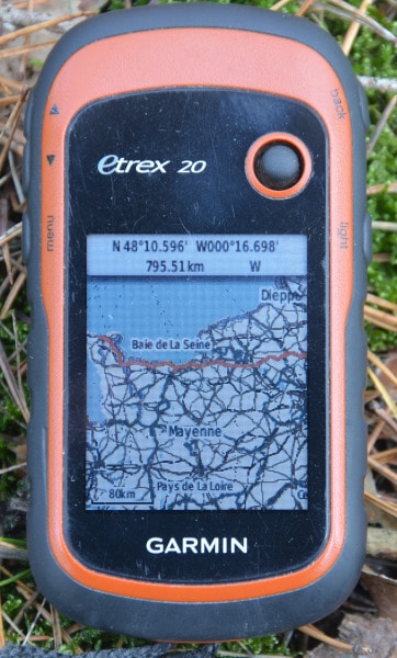
My Garmin – GPS handheld navigator has an free openstreetmap map for Thailand and is supposed to help me. So I can see how well the area is mapped and what the openstreet-mappers found so interesting.
The smartphone shows you your way and follows you throughout the day
I know, most of you would just take the smartphone and search at tripadvisor if necessary … But I don’t have anything like that. Consciously not. As long as there are no smartphones with free software (like Linux for laptop and PC) that offers nearly the same features as the current apps and meets my requirements for data security/privacy, I will not accept such a pocket bug. Because the services of „Aunt goggel“ are mostly free of charge, but not for nothing. With your convenience, this company (and some others along with it, including the growing danger of governmental abuse) buys your data, your CV, your thoughts, your circle of friends and above all the power to predict and change your future.
Paranoid? So far, unfortunately, everything that has become known about „Big Data“ and its evaluation has shown that the truth is much worse than our imagination might imagine. The big data collectors gog, fakeb, amz and subcontractors with access to the data treasure have the power to change the way masses of people think via their platforms and the results of the search engines – and thus to steer the future. Democracy is in danger! In future elections will be won by those who have the resources to influence groups of voters via social media channels. I think most people are not even remotely aware of the dark sides of digitalization.
Project openstreetmap – a free world map to tinker with
But this only on the periphery. There are also counter-movements (even if they are only partly really understood as „counter-movements“). The open source scene is one of them. Part of this scene are the openstreetmap activists. With openstreetmap (osm) a free world map has been created, in which many hundreds of thousands of people all over the world work together. The database is getting denser and denser – in some cities like in the east german Leipzig, where many activists are involved, almost every street tree, every mailbox, every „Schlauch-o-mat“ (german for bicycle tube machine) etc. is mapped and road construction sites are often entered to the day.
Meanwhile there are already special maps based on free osm – maps and different offices and research institutions use the map base for their purposes. Unfortunately, there are of course still sparsely populated, rather „technologically distant“ regions on earth for which some data is still missing. However, this is often not so much different with official maps. In the remote mountainous regions of Laos I have reached my limits with osm maps. God knows that the people there have other things to do than to record the mountain paths they are familiar with by GPS tracker.
License expressly permits free use
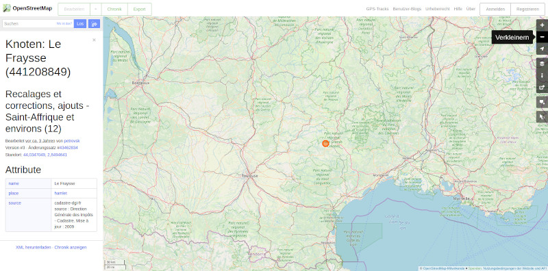
A big advantage of openstreetmap charts is that anyone can use them freely. You don’t have to fear a reprimand if you show your company or your hostel with an OSM-map on your website. You are allowed to use the maps at any time, provided you mention the source. It is not for nothing that Deutsche Bahn has started to use osm maps to show the surroundings of its major railway stations. Even in the german TV crime series „Tatort“ an osm-map was used for the crime scene – much to the delight of the streetmapper scene. And the Tagesschau currently shows the spread of the coronavirus in the world on an osm map. I regularly link places and regions on the osm- website – where you can mark your start and destination with a right click and search for your way as a pedestrian, cyclist or by car.
Furthermore, the density of details allows you to use filters that fit your purposes and to filter out e.g. a hiking map with elevation representations, a cyclist map with road surfaces or repair service facilities or even a car map. And then save them to your GPS navigator device. Or if you have just moved to a town, you can check out the area online and find the nearest ATM or mailbox…
Diversity of participants strengthens the density of detail
It is nice that the creation of the openstreetmap – world map – like wikipedia – is done by the activity of different people. Everyone can participate. This has a positive effect, because everybody sets different priorities for his life. One of them is perhaps a passionate cyclist and collects all the information that is important to him as a cyclist. Another may be in a wheelchair and collect the relevant data, so that a wheelchair map can be created using suitable filters. (for wheelchair-maps look into the project wheelmap.org !)
There are tools like the free open-source program josm (java open streetmap editor), with which you can download the desired small map section, enter your changes and then upload them again. After a few hours – the new raw data must first be „rendered“, i.e. graphically prepared, your additions are entered. A democratically developed map, so to speak.
However, there are limits. In the accuracy as well as in the „officiality“ of the representations. Hans-Wilhelm Hurt has written a good and not uncritical post in German at radrouting.de (GPS for bicycle friends) in 2018. He is a trained cartographer and quite OSM-friendly, but he also sees the partial weaknesses of the project. If you are technically not able to create suitable Garmin maps, you can buy them from him.
openstreetmap also on smartphone – Apps
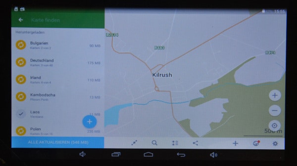
Of course, there are several smartphone apps that use free osm maps. Osmand is a project that I recently got to know about. The app Osmand is currently the best developed app for openstreetmap – maps. Cycling, hiking, car routing, everything is possible with the right profile. If you discover mistakes or changes in the meantime (e.g. your favorite café has a new name), you can initiate quasi live changes in the openstreetmap map base. As far as I know, the osmand – app costs 9€ in the goggel play shop, in the free app store f-droid it is for free.
Or, already older, maps.me With both you can download osm – maps for your target region and use them offline. This is important for regions where you can’t be constantly on the road in some wifi network. This also uses openstreetmap – cartographic material. But the handling is a bit cumbersome and only partially exploits the wealth of information from openstreetmap. With both apps you can download osm – maps for your target region and use them offline. This is important for regions where you can’t be constantly on the road in some wifi network.
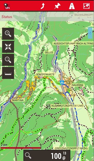
The android app oruxmap can now display Garmin map parts. (i.e. .img – files created for Garmin, see below) These are not routing-capable, but you have to use the orux everytrail.com – maps.
Use of openstreetmap – data on GPS navigator devices
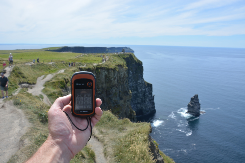
But also different GPS – navigatores are „osm – suitable“. Not every one from the beginning. Some manufacturers want to earn money not only from the device, but also from the sale of compatible maps. On the Internet you can find information whether certain devices are „osm-ready“. I have been using a Garmin eTrex* handheld navigator for several years. These are usable for osm- cards from eTrex 20 navigator and higher. However, the map data must be converted into the Garmin-typical format. There are different web pages for this purpose. Either you can download the free garmin map for your target area directly or sometimes you can select an area and let it be calculated „fresh“.
The free osm maps for Garmin handheld navigators are then called gmapsupp.img. Usually you will get a .zip-folder containing the map files. After unzipping you should rename the file immediately, e.g. to cyclemap_wales_201912.img or something like that. Then you know what is stored in the file. It makes sense to indicate the download date, because you can see how old the map information is. Save the osm map file on the Garmin (micro-)SD card, activate it in the menu as your regional map and off you go! You can have more than one map activated, but it makes sense to deactivate regions you are not currently in.
In general, you should make sure that the openstreetmap chart offers are regularly updated – this way you will benefit from the latest information. Some computer-savvy hikers or cyclists also create specially filtered osm maps for their target groups. Otherwise, the general maps are usable, as they contain all relevant data. It then depends on whether your GPS navigator can further filter the map data for your purposes. (E.g. suppress motorways for cyclists, avoid gravel roads, etc.) ) Garmin even sells prepared osm maps as a cheaper alternative to its own map sets. (With the restrictive remark that these are non-verified map data from the Openstreetmap – project and Garmin does not guarantee the accuracy of the maps)
6 Free download Sources for OSM maps for GPS navigator devices
Here are some links to websites where free openstreetmap charts can be downloaded for different regions and purposes. These are prepared for Garmin GPS navigator devices in gmapsupp.img format (unless otherwise specified). For other GPS devices, there are probably similar offers, but I’m not familiar with them, just look down there to bbbike.org or search for them yourself e.g. at ecosia.org
Download leisure and hiking maps
- Freizeitkarte-osm.de offers free leisure time Garmin maps for European countries updated every 2 months according to own information. Routable, useful for hikers, cyclists etc., but also for car routes
- opentopomap offers the topographically prepared Garmin OSM maps with weekly updates every Thursday. Very detailed e.g. for hikers with orienteering – background.
- At alternativaslibres.de you can find the OSM base maps for almost everywhere in the world (restrictions are explained), usually updated daily, contain the essential map information of Openstreetmap
Download cycling maps for Garmin
- An interesting download – source for free openstreetmap files in different formats is bbbike.org – not only for Garmin GPS, but also for Osmand and Maps.me – Apps and others. Plus various „specializations“, i.e. road map, bike map, recreational map or topographic map…. I am enthusiastic about the possibilities to display „Latinized“ place names for many regions (as far as they are stored in the osm base data) – then the map is also very helpful in Thailand or Laos, where I otherwise can’t even read the letters. There are about 200 locations worldwide preconfigured for immediate download, updated weekly. You can also choose your destination area individually and download an up-to-date osm-based map dewy fresh in the GPS format of your GPS navigatorvice. A donation is requested, because the server costs alone are 10€/d.
- It is a bit more difficult with velomap.org or openmtbmap.org . The first osm map is for road cyclists and long-distance cyclists, the second osm map for hikers and mountain bikers (so also with smaller off-road trails). Both routable and updated weekly for Europe. Here are only the desktop versions directly downloadable. Either you convert these on your PC still in Garmin *.img – maps or you become for one year/20€ „Premium – Member“ and can download the finished Garmin *.img- packages directly. The edition for Austria is available for free in both versions.
More download – sources for Garmin osm – maps from bike to sea maps
- My most frequent source, since it is very variable and comprehensive, is the Dutch site http://garmin.openstreetmap.nl/ Provides free Garmin routeable base maps and cyclist maps from openstreetmap, but also (non-routing) marine maps from the openSeamap project. You can select countries by default and regions from the – regions – tiles of a world map. A transparent contour line foil is also available to complement other base maps
- The OSM wiki entry should not be missing. Although not quite up-to-date, the table contains some more sources for special Garmin maps (mountain bike, cyclists, hiking etc.)
- For the compatibility of openSEAmap charts on Garmin, Lowrance, Simrad and B&G navigators here the info from openseamap
GPS handheld navigator devices – robust technology for outdoor use
Another advantage of the GPS handheld navigator compared to the smartphone is that they are very robust. The Garmin e-Trex is definitely waterproof and shockproof. It can also be fed with free maps from the osm branch openseamap and then serves as a sea navigation system and sea chart display. (The map links for land based navigation Cap Verde and Tobago in my travel story „Under sail across the Atlantic“ refer to the openseamap – maps)
The disadvantage is – but this is no different with the smartphone – that satellite navigation eats up quite a lot of energy and therefore the batteries do not last very long. This is something to keep in mind if you are out and about somewhere far out in the world. But when hiking or sailing or other activities far away from civilization I would use the good old paper hiking map anyway… at least as a backup. At sea, the updated paper nautical chart is mandatory as a means of navigation. Electronic nautical charts may be used, but only in comparison with the nautical chart.
And the e-Trex handheld GPS devices have the advantage that they use normal AA batteries, which can be bought almost everywhere in the world.
Decision support in case of too many options
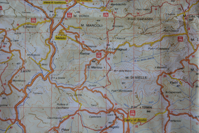
The navigation system is cool especially when there are a lot of routes. In Tuscany some years ago I didn’t have a GPS navigator device yet, only a rather bad Italian „hiking map“. I failed on my hike from Sienna to Florence because I entered many paths which turned out to be the access to another of the scattered wine estates after 500 m. With the „Navi“ GPS device I would have noticed after 10 m at the latest that this branch was the wrong one.
But also otherwise it is practical. Especially in the confusing places in India or Southeast Asia I mark a waypoint in front of my accommodation after my arrival, just to find back easier. With the non-existent or unreadable street name signs (who can read something like Thai or Malayalam?) this helps me a lot.
Basic function – Where am I?
A GPS handheld device helps you even if there are no more paths. Of course, then the „routing“, which calculates the fastest or, depending on the default settings, the shortest or safest way via roads and paths, is no longer possible. But the GPS navigator still shows you where you are, if necessary with the map basis underneath. Depending on the relief and obstacles, you can create an (out) way by setting waypoints for individual sections and running on them. This is also possible at sea – waypoints that are approached stage by stage.
Or, if I’m travelling in a foreign country by bus or train, I always check with the GPS device, where I am and how far it is to the finish.
Useful additional navigator information
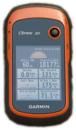
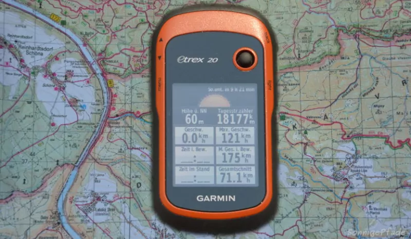
The travel computer of the Garmin handheld navigator shows me not only speed, altitude and other „technical data“ but also the time until sunset. This is important for sailing or especially for winter hiking, to be able to estimate when it will be dark and how much distance can be covered.
So, what was that about pizza?
I go to „Destination input“ in the GPS navigator menu. There are different sub-items like „all POI“ (points of interest), sights, food and drink, means of transport
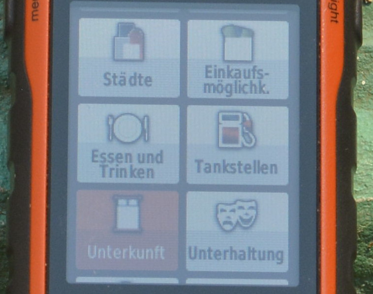
So I have already discovered many a treasure along the way by looking at the POI’s of the nearer surroundings. E.g. another cave near Tham Lot in the north of Thailand, which has been abandoned in the meantime.
Then there are usually subitems like „food and drink“ then „all“, „American“, „Asian“, „barbecue“, „fast food“ etc. It depends a little bit on the classification the mappers have made. Pizza should be classified under… „Italian,“ right? Unfortunately, this is the wrong place. But a few fields further on there is „Pizzeria“ – hit! About 880 meters on foot – I can just manage that.
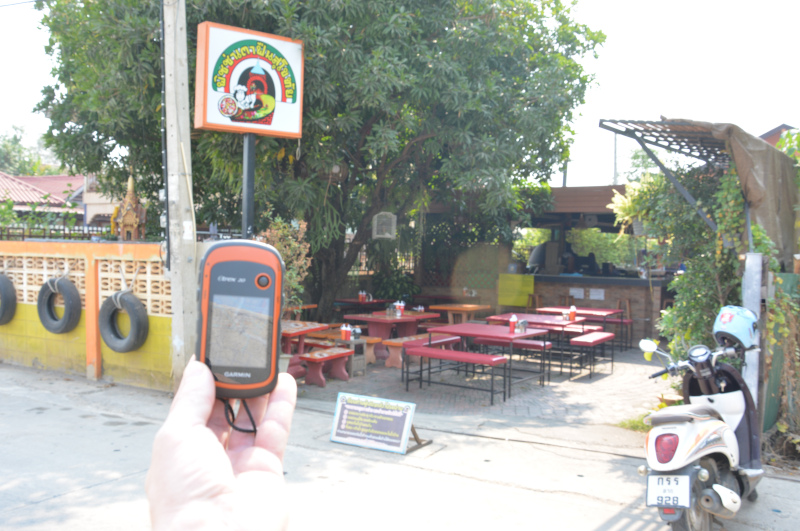
And wonderful – there is really pizza from the wood oven! In the middle of Thailand, in New Sukothai! The tables are full – a lot of Chinese families have gathered here for the „Chinese New Year’s Day“. But there is still enough space for me and this pizza tastes quite Italian 🙂 That’s what I often do when I’m in a foreign city – just pizza – cashing.
Current GPS handheld navigator models for every demand
The entry level model is the eTrex 25 Touch*. In the meantime, all Garmin GPS navigators have been equipped with a touch-screen, which makes operation much easier. Apart from that, not much has changed, at least for the simplest device of the series. The construction of this handheld GPS device is proven robust, the case is waterproof, and two AA batteries (or rechargeable batteries) are still used. The endurance is indicated with up to 16 hours. A new feature is that a bicycle handlebar mount is included in the basic equipment, just like an already installed base map „topoAktiv“ for Europe or depending on the place of purchase. The internal memory of 8GB can be extended with a microSD card.
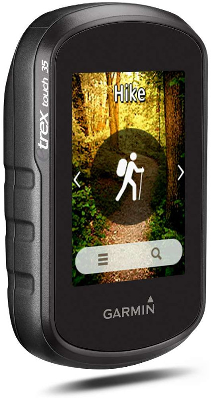
Geocaching – Fans will love it: Externally almost identical, but with some additional features in detail, the eTrex touch 35* GPS handheld navigator comes along. In particular, there are 250,000 pre-installed GeoCaches and the possibility of coupling with the smartphone. The latter can stay protected in the backpack in wet weather, because the messages are displayed on the eTrex 35. Same weight as the eTrex 25 touch 159 grams with batteries. And all the Garmin handheld GPS devices can be feed with free downloaded openstreetmap charts.
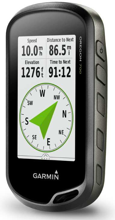
One league higher plays the handheld Garmin Oregon 700* GPS navigator. The connection with the smartphone is further developed – it is wifi and bluetooth capable. This makes it possible to easily reload additional geocaches on the road. In addition, e-mail and sms messages as well as the alarm set on the smartphone can be transmitted. Also the weather radar can be displayed, so that you are informed about the weather situation of your surroundings while you are on the road. To strengthen the basic function the antenna performance has been improved again. Additionally available is a Ni-MH rechargeable battery pack with 2x2000mAh*.
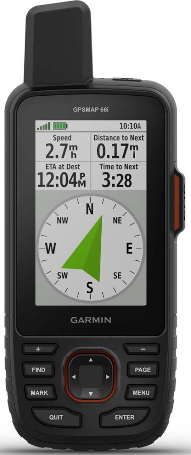
High-end for professionals – the Garmin GPSMAP 66i*. In addition to the excellent GPS functions, it also offers two-way communication via the global Iridium network and an emergency call function that can be used to trigger an alarm in the GEOS emergency centre. All this is independent of land-based communication channels such as mobile phone networks or similar. This makes this GPS navigator an indispensable companion on excursions far away from the nearest civilisation. The battery life can be extended up to one week by energy saving modes.
Practical Tips – Prepare bike tours and hikes using GPX tracks
GPS – design and download track on your computer
The use of GPX tracks (file format .gpx) for hiking or cycling tours is practical. (Of course you can also use it with a car…) I use maps.openrouteservice.org as source. This routing system is based on openstreetmap maps and can suggest tracks which you can download and display as .gpx file on your GPS navigator device. I have used it for my bike tours through France and Ireland.
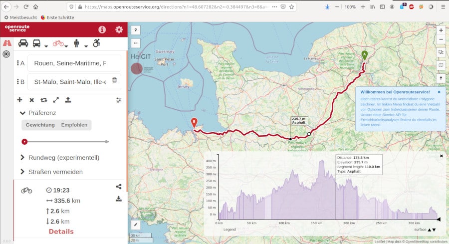
Especially in places where there are no long-distance cycle paths, you will get an optimized routing. In Ireland, for example, extra – cycle ways are still rare (I only know the Green-way near Waterford and the Blue-way near Tipperary). But there are a lot of small roads off the main roads, which connect the scattered settlements – and all in all they are a good network of cycle paths. There is little traffic there, and often a green strip grows from the middle of the road.
When I was in Ireland for the first time in 2003 with a friend and also on the road with my bike, we only had a bad road map with much too large scale and otherwise hints from the residents along the way – who unfortunately always wanted to send us to the next big highway. Typical car driver – the easiest way to get around is via the highways… But we wanted to avoid these roads as much as possible.
Today I’m looking for the best way from Tipperary to Kilkee or Rouen to St.Malo at maps.openrouteservice.org with the setting „cyclist„. Of course, there are other options for this too – shortest way, fastest way or if you have time and want to explore the country, the recommended way. Then existing cycle paths will be integrated as far as reasonable. This is usually a bit further, but often opens up really beautiful areas and is, as far as possible, cyclist-friendly.
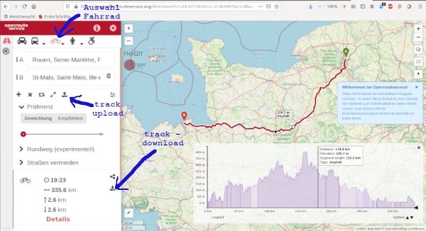
Of course you can also set some waypoints in between if you want to go somewhere. You will also get a graphical altitude display. On this map you can navigate with the mouse to the high and low points and you can see on the map behind where you can expect the biggest ascents. If this is too much for you, you can shift the route a little bit and get another, but maybe easier route. At the same time the road surface is mentioned. If you plan your trip with a super light road bike, you can plan the routes with gravel or rough pavement from the beginning and avoid them.
On the way orientate at the .gpx – Track
Download a suitable map and the .gpx track to your computer and then to the track directory on your GPS handheld navigator. Choose a meaningful track file name before downloading, e.g. Roscoff-Brest_direct_xxxkm.gpx ! This way you can easily find your desired route in the track manager.
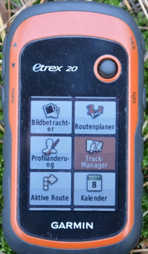
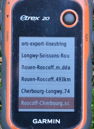
If you are at the starting point of your journey, you choose the right track file in the track manager and have it displayed on the map as a coloured line. Real „routing“ is also possible, i.e. as usual with a navigation system, you can display the route with turn-by-turn instructions etc. („next traffic circle 3rd exit„). But in my opinion this is not necessary when cycling or hiking and I appreciate that this is an energy-intensive pleasure. Your route will be constantly checked for deviations and if necessary, the route will be recalculated just because you drove 30m left to the ice cream stand.
In any case, with the help of these tracks you can get to know a country very well and make nice bike tours, even if there are no designated bike paths. Only the first few kilometers behind traffic junctions and into or out of cities can be exhausting, if there are no good cycling routes anyway. The Euro(cycle)route 1 e.g. in Ireland from Rosslare-Harbour westwards along the coast consists only of small local roads without „extra“ cycle paths, but are rarely used by cars.
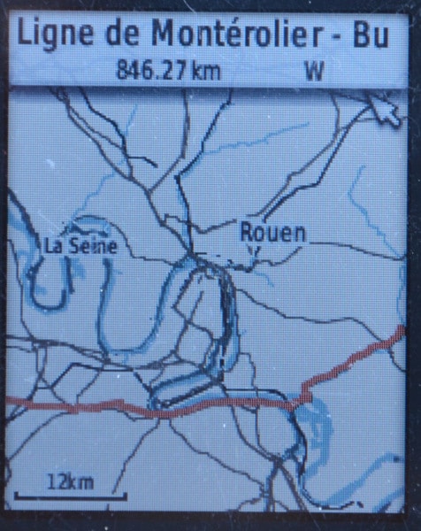
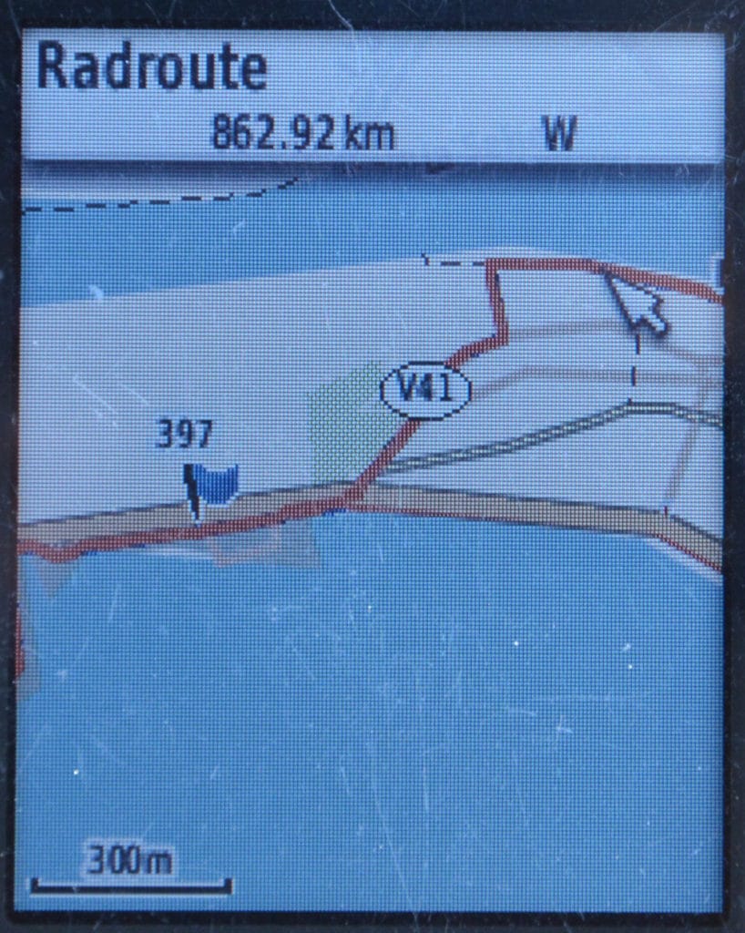
The track also works without a routable map or even completely without a displayable map base. In the border triangle France-Luxembourg-Germany I suddenly got into an area that was not covered by my available maps on the Garmin. The track was displayed anyway. I zoomed in so far that I could find my way just by looking at the track markings. It worked fine until I was flying blind and landed on the next map.
Especially in this case, but also in other cases, it is important to select the appropriate magnification of the display on the GPS handheld navigator. On the small display of Garmin eTrex navigator devices this is 300, 500 or 800m per cm display for cyclists. You have to try this a little bit at the beginning to find out what suits you best. If you choose the zoom level too coarse, you will often pass the right turnoff. As a hiker on narrow paths you have to choose the most accurate zoom level, otherwise not all paths may be displayed and parallel beginnings of paths are difficult to recognize. But with time you will find your optimum and enjoy playing with your personal touring track.
Note on advertising links
Some links are marked with *. These are so-called affiliate links to online merchants. If you click on such a link and buy something in the shop, I will receive a commission, which I can use to create this blog. Nothing will be more expensive for you, because the commission has already been taken into account in the pricing.
Source product photos: Manufacturer/ Dealer

