By bicycle through the north of France – Part 2
The night at the edge of the field near Berry-au-Bac is quiet and pleasant. It is warm, stars are above me and only a few noises penetrate the clear June night. Only in the morning, the sun has already risen early in the east over the channel, I hear the humming of a ship. But these are only two houseboats, which I saw the evening before at Berry-au-Bac on the shore and which continue their way towards Reims. On the outskirts of the town the mill is now also going into operation, perceptible by another hum in a higher pitch.
(continuation of Longwy – Reims by bike, contains a little *advertising)
I pack my stuff into the bike bags and push the bike over the embankment. Then I use the sunny place again for my breakfast, which as usual consists of baguette with honey or „cart grease“. This gives me the necessary energy boost for the morning stage.
During my breakfast, there are two cars passing by on the bike path. Both are service vehicles of the „VNF“, the French waterways authority. In the meantime, a VNF employee has also started to mow the already short embankment lawn even shorter with his lawn tractor. All in all, working for VNF also seems to be a pleasant job, on many green river banks and lonely locks with little traffic
Now I really start my journey westwards along the Canal de l’Aisne, where I had already noticed the evening before that it was getting a bit exhausting. Because there is not even a path here, only mowed lawn as underground. Well, maybe this will change again after a few kilometers. My actual track runs further north of the Aisne, but I don’t feel like exchanging the varied path beside the river for a probably rather boring road. So I have to put up with the effort for a while.
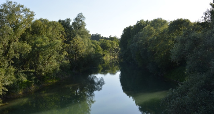
The river is less clean than the channel yesterday. Many algae cloud the water, also the vegetation is stronger. After a few kilometers there is an iron girder bridge, which has been on the hump for several years. It seems to have actually been built for a railroad, because besides the pitted road surface there are also old railroad tracks in the bedding. But whether trains have ever driven over it is questionable – nothing suggests that the bridge, which rises high above the flat land, is connected to it.
Unfortunately, my „canal-accompanying path“ has come to an end and I have to change to a dirt road further south. This leads with curves and many holes to a road that crosses the canal again. And from there on there is a sandy path closer to the canal. Still in sight of the road bridge I discover a small square from which an open embankment reaches directly to the bank of the Aisne. Since it has become quite hot and I’m sweating a lot on the bad roads, I take this opportunity for a bath. A stick to set up my bike with is easy to find. It had been collected as firewood for a small fireplace. Now it serves me as a bicycle stand.
After the refreshing bath I continue on the hilly path. This is probably not an official path, only the fishermen use it to get to the different fishing spots on the river bank. But at least it goes on – until it suddenly leads south at a right angle away from the river. Now I have to get back on the road.
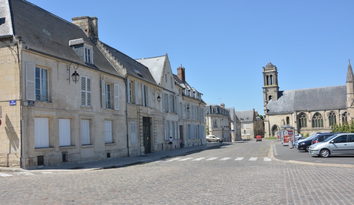
My first destination on this day is Soissons. Years ago this was the starting point for the boat tour through northern France. However, I did not see the city itself. The river boat was outside near a lock and we went there directly. Now I wanted to make up for the „missed“ and pay a visit to this city. Over an Aisne – bridge I reached the center between „Hotel de Ville“ and the Abbaye St. Legér. Of course I was again looking for a „Doenerman“ for my late lunch. But that turns out to be difficult. It is somehow strange – is it due to stricter corona measures or strange opening hours? In any case, some beer houses and ice cream vendors are open and enjoy a lively life, but the snack stores are closed. So the only thing left to do is to live on yogurt and „backpack-food“ and to look at the city with a half-empty stomach. Is it because I don’t like Soissons as much as I expected?

My imagination was also somehow shaped by a city in the countryside with the river and picturesque banks …. Instead, the „Place de Hotel de Ville“ broods as a stone-dusty parking lot in the afternoon heat. And many other streets of Souissons also lack the greenery. Yes, there are some nice houses here too, and the cathedral is impressive. Impressive… but somehow also only half-finished. Anyway, it looks like this, with 1 1/2 tower. And since a large part of it is scaffolded and two thirds of it is surrounded by building site and construction machinery, this impression is even stronger. Also the Aisne bank does not seem to belong to the city. It lies „one floor below“ and can only be reached via busy roads. The riverside path, as far as it exists, seems a little neglected and there is nothing to sit and linger on. After two or three rounds in the city center of Soissons, I sneak onto a shady bench in a green area and read a little in my eBook. At first the heat is too great to motivate me to continue.
The main road is quite busy and not a pleasure. But soon there are small country roads again, pretty villages with small castles, refreshing forest and summery landscapes.

A surprise is the small town of Pierrefonds west of Soissons. Only a short drive through was planned. But while looking for a morning coffee and a few additions to my food I discovered an impressive castle. And in front of it some streets of a very beautiful village, which is worth a detour. A kind of summer resort, with hiking trails and gondola pond. To the west, the village is surrounded by large forest areas. In the middle of it, another highlight – Saint Jean aux Bois. An abbey in the middle of the forest including a small settlement, originally probably houses of the „civil workers“ of the monastery. Today it houses several hostels and restaurants – not exactly cheap offers. But the complex lets the imagination wander into the Middle Ages, where no tourists with cars and motorcycles came to the area yet. This must have been a very hidden settlement – far away from debauchery and consumption, an oasis of contemplation.


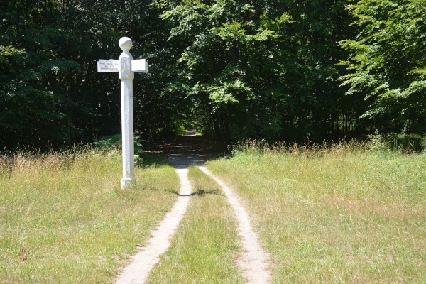
The trail continues westwards through the forest of Compiegne. It seems huge, at least compared to all the forests I have crossed on this route before. A straight-line system of paths and white columns, which remind of border markings, indicate that it is a state forest or a former „royal“ forest. Almost all of them are gravel paths, only at the end there is a small asphalt road.
Then I reach Lacroix-Sant-Ouen and thus the Oise. In search of a bathing place I drive the shore road a few kilometers northwards. Unfortunately, the embankments down to the river are mostly steep and sloping. At the only possibility I can descend only over granite blocks. A group of youths approaches this section of the bank from the other direction. They greet me friendly while passing and camp a few meters further on. All boys, only one girl is with them. The bath in the Oise is a real refreshment. The days are now „hot as hell“ and I am getting more and more tanned. On the river there is a lot of shipping traffic. That makes for a good rocking in the waves. After the bath I rest for a while in the shade of a single standing oak tree. The boys next door are romping around in the water, the girl is sitting a bit away. And one of the boys, probably her boyfriend, stays with her considerately and with a certain pride in her attitude.
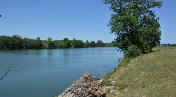
To get across the river I have to use a narrow car bridge. This bridge is only one-way drivable. A traffic light controls the direction. With the bicycle I am a bit slower than the following cars, but nobody honks or pushes. Then it goes a bit further along the road. Such bottlenecks are always a bit annoying. Luckily the turnoff is coming soon and then it gets quieter again.
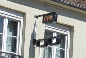
The next day I reach the city of Clermont. Also there I torture myself up a mountain again. The old center of the city is actually located on top of a mountain. Church Saint Samon so to speak „toponthehill“. The city hall „Hotel de Ville“ a bit below at a place from where you look down into the shopping street. If all this wasn’t so exhausting, this could be directly beautiful! No, it is beautiful. The thermometer above an optician store shows +44°C. (ok, it also hangs brightly in the sun).


Signposts tell me that I am now on the cycle path „Paris – London“. In fact, now cyclists come along quite often. However, they are not wandering cyclists with luggage like me, but rather „flocks of finches“ in colorful cycling costumes with narrow-tyred racing bikes. At Boulincourt I decide to have an extended lunch break in the shady forest today. But I prefer to ride in the morning in the coolness and then in the evening a few more kilometers. About 3 hours I lie on my mattress in the shade of an oak tree. My sweat is running in streams. As I continue on my own tracks through the forest, I discover that only 1km further on there would have been a small pond in the forest for swimming. From the parking lot families with plastic ducks and inflatable palm islands drag themselves through the forest. At the pond there is already a pop station roaring from a box. Anyway, it is too late for the resting phase…
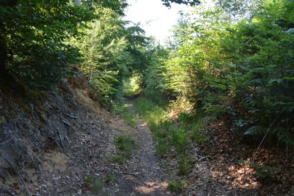
Since the forest is not on the track, I drag myself uphill and downhill over sandy forest paths. I hope to cut a few kilometers off and then get back on my marked trail. The paths get narrower and narrower and suddenly it goes steeply downhill on a ridge. Hopefully there is a continuation down there. I can’t get up this climb again! The brakes are hot, nevertheless I roll and slide down the leafy track. On the other side it’s just as steep back up again, but luckily there’s also a path to the left. There are hoofmarks to be seen, apparently this path is preferred by riders. It goes in an arc around the hill. Soon I come across a road covered with splinters. And this leads out of the forest. In the next village I am back on my track.
Towards the evening the weather closes in and rain comes up. I camp at a bus stop and pick out my laptop. Beauvais is not far away. Via online search I book a hotel room in the city. Since Luxembourg I sleep in a bed for the first time again … and above all I do the laundry. Garmin* leads me to the hotel, I check in and start doing the laundry immediately. I only have one night to dry. Across the room I stretch my tarpleine and hang everything up. The air conditioner has a fan, I let it run to make sure there is enough airflow. Otherwise the drying in the small room will not work. Besides, all batteries have to be charged and I can surf the internet without too much time pressure. Well, the night is short, checkout is at noon, time is running out. But I manage to post the already largely finished article about the Vennbahn – Radtour, including the most important pictures.
The next day I have to visit the city of Beauvais. I have been there before, but that was 17 years ago. The only thing I can remember is the cathedral – and it is still impressive today. Apart from that, there are an amazing number of houses in the city center that are more recent. I would not have expected that. Besides the cathedral, the former bishop’s palace is valuable and historic. This Renaissance building houses the Musèe de ‚lOise, or le MUDO for short. It contains paintings from the Renaissance to the present day, medieval sculptures and ceramics and a collection of new works of art. The bishop’s palace was originally built in the 12th century and was fortified in the 14th century with two entrance towers, as times were restless. A reconstruction in Renaissance style was carried out in the 16th century.


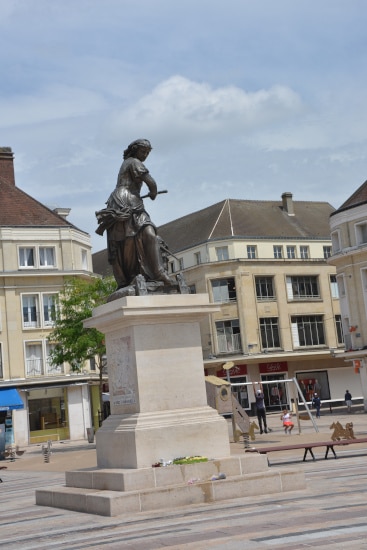
The city stroll goes past the town hall and across the market. There is also a monument for Jeanne Hachette. That is her „battle name“ – „Jeanne Little Axe“. Legend has it that she fought together with only 300 defenders when the Burgundians invaded the city in 1472. When one of the Burgundian soldiers wanted to plant the flag of victory on the city walls, Jeanne Fourquet, armed with an axe, pounced on the enemy, pushed him off the walls and tore down the flag. In this way she gave new courage to the disgruntled defenders and the city could be successfully held.
At the western end of the town, a bicycle path begins on a dismantled railroad line. There I meet a Tibetan, also by bicycle. He is a little lost and asks me how to get to Beauvais. Fortunately I can at least tell him that pretty much. We talk for a while. Then I take advantage of the hour and cycle along the cycle path in a relaxed manner. There it goes fast! After a few kilometers there is a big amusement park on the north side. But everything is closed. Only a few technicians are on the road. On an old railroad bridge I squat down in the slipstream of the concrete enclosure and cook myself on my beer can – stove, newest version, a Spirelli soup. This still takes some time, but I can just eat my fill. My energy needs are immense anyway.
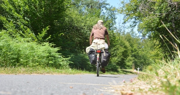
Printouts on yellow paper hang everywhere at the „level crossings“. Some kind of warning notices. But I can only understand station. Later I can translate them with deepl.com – it’s about the oak procession moth. This is a butterfly that lives in oak trees and is probably very common here again. Its caterpillars secrete a poison that can severely damage human skin under sunlight. In recent years, there have been frequent summer mass infestations of the Oak Processionary Moth in Europe, possibly due to the unusually warm winters.
It is still the Paris – London cycle route. And regionally this is additionally marked as „Trans’Oise“ – cycle path. A nice route to „make meters“.
But unfortunately, this cycle path also ends suddenly in a bush – in other words, the expansion stage is over. And once again I get stuck in a town: Saint Germer de Fly. This is also an old abbey, but with a real village around it. The huge church is a kind of double chapel or double church. In the east, where simple churches have an apse attached, there is basically another somewhat smaller church, the Chapelle de la Vierge. I have never seen it like this before. Also this whole complex is not in top shape at the moment, so it’s not „sandblasted and persil-washed“, but together with the place this is what makes it so attractive. As I already wrote in the first part – it doesn’t look postcard idyllically polished, but authentic. I feel rather taken back to times when perhaps hundreds of monks in black robes and long rows still went to prayer here. Unfortunately a thunderstorm front is moving through and I am stuck in a bus stop again. But the rain does not last long and I can continue my journey.


At the moment the mountains are not that bad. Sure, there are hill chains to overcome from time to time. But mostly it goes more or less on a contour line westwards. The roads are still small side streets with little traffic. But there are much more villages than in the first part of the tour to Reims. There seems to be more construction, also on designated „home sites“, where 5, 6 or more relatively similar houses are built. Nevertheless, many of the towns have some beautiful, historically significant buildings that give the region a face. Above all, I increasingly see half-timbered houses, often with mud walls – a sign that we are moving in a river plain. The half-timbered houses are different from ours – there are less horizontal struts or bars, but mostly long, upright stems with hardly any cross connections. Instead, they stand relatively close together. Which is all the more surprising – there are even more thatched houses! That is here, still „in the middle of the country“, but somewhat surprising. Does the raw material come from the banks of the Seine? Or from the banks of some of the fish ponds that are found here in some places? I can’t find answers to this question…
With the night camp I am slowly becoming reckless. The last night before Rouen I spend in a big forest. It is nice in the late evening – I lie down, the tarp wrapped only beside it. If necessary I can… In the middle of the night I wake up. There is lightning and thunder around me and rain begins to rattle down. Otherwise it is pitch dark. Not even my flashlight I find so fast. I just gather up my sleeping bag, throw the tarp over me while sitting and try to spread it out over my place as good as I can. Especially the sleeping bag I protect like a mother hen. That works quite well, but apart from that it’s over with the night’s rest for now. The lightning flashes around me, followed by violent blows only fractions of a second later. I’m not a scaredy-cat, but I do have some thoughts in my head… will I be found here weeks later? Will I now share the fate of the „Dead Maid„? And if I do, will the wanderers still lay down flowers centuries later or will everyone say ‚It’s your own fault‘? It takes a long time before the thunderstorm leaves and takes the rain with it. When the time has finally come, I start to prepare my camp in the flashlight. A few thick blackberries – strands are very annoying – because of them I was so averse to setting up the tarp the night before. The risk of tearing big holes into the tarp seemed to me to be bigger than the risk of rain.
The morning acts again as if nothing had happened. That’s right, everything is fine, only the mattress, the tarp and some small corners of the sleeping bag are wet. Everything is not so wild. Today the trip to Rouen is on the schedule. From Longwy that’s 426 km plus the side trip to Reims and a few small deviations, because I often get lost. To save batteries, I always turn off the Garmin GPS in between, when it is „only straight ahead“. But it depends on the scale – sometimes there are small tracks that deviate slightly to the right or left of the main road – and I am 4 km away from the track. Because I like to get off the track when it’s really rolling and I want to eat a few kilometers quickly.
To get into Rouen, I have to take a big road again. There it goes down the mountain in a raging speed. The Seine valley is a deep cut into the landscape. And my load pushes! Such a frenzy is almost scary for me. Later I come to a small side street. This one follows a small river. Several water mills are standing here, some of them still working and in museum operation!
Then I reach the center of Rouen. I have booked a private accommodation. In the automatic reply I am promised to send information about access (a key code). Now I hope that this all goes quickly, then I will have a nice evening in the city. I have already seen some corners with inviting pubs and partying people in front of it. But my stage celebration – after all Rouen was my first track – finish in France – will not become anything. The lodging operator leaves me hanging, doesn’t answer the phone either. After one hour I call the hotline of bookingcom and describe my problem. The service employee sends a mail to the owner, after his call did not help either. Half an hour later I have to call again. Then a woman is on the line. She tells me that the owner is not available and cancels the booking. She looks for a replacement accommodation within 10 minutes and promises me that bookingcom will cover the additional costs. This brings me to a hotel at the edge of the center. This is really quite good – especially for drying my tarp and sleeping bag. But meanwhile it is already half past nine and I don’t feel like going out today. I’d rather catch up on some sleep and use electricity and the wifi network.
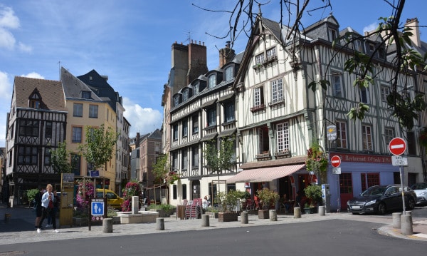
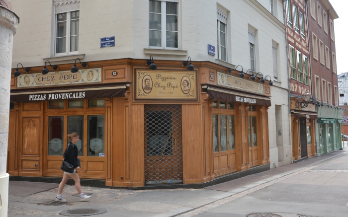
The next day is a Sunday. I leave my luggage at the hotel and cycle a bit further into the center. Unusual how easy it is all of a sudden! Then I do my city explorations on foot. Rouen has several large churches. First I pass the Abbatiale Saint Ouen, which is located at the Place du Générale du Gaulle. The palace next to it is the city hall… not all from bad parents!
Also in the center of Rouen, there are a number of such half-timbered houses, as already described – many stands relatively close together without struts… Some of the narrow streets are very beautiful, especially because of these rather irregular, sometimes crooked houses.
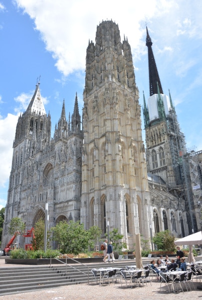
If this „monastery church“ was already quite large and impressive, the Cathédrale Notre Dame towers many times over the surrounding houses. The huge portal has almost countless pinnacles, turrets, figures, windows and decorative gables, that I am almost overwhelmed with the view. Claude Monet captured this façade in a serie of paintings in 1894. More colorful than the original – stone. Three different towers characterize the building and are visible even from far away. The north tower has a pointed pyramid roof, which ends in a short ridge on which two crosses stand. The south tower, on the other hand, has a square base over almost the entire height, i.e. it is square, but on top there is a cylinder. These statements are only theoretical – due to the many decorations the geometrical figures are largely resolved and the shape is so filigree that a description is only possible in rough outlines. The crossing tower, however, is crowned by an upward striving peak that towers above everything and shoots steeply into the sky. Shortly before the end a bell is built in again, without which the rising lines would probably seem almost boring. But despite this small interruption, the steep edges continue above and end in the height with a cross on which a bird (a crane?) stands.
Directly opposite the north tower, the Rue du Gros Horlage flows in, where a gate with a golden clock stands. This reminds me strongly of the Apostle Clock at the Prague City Hall. An old, unforgotten impression from one of my first trips in my youth.

Further west, the Palace of Justice is quite a sight to behold. Especially in the area between a number of modern department stores.
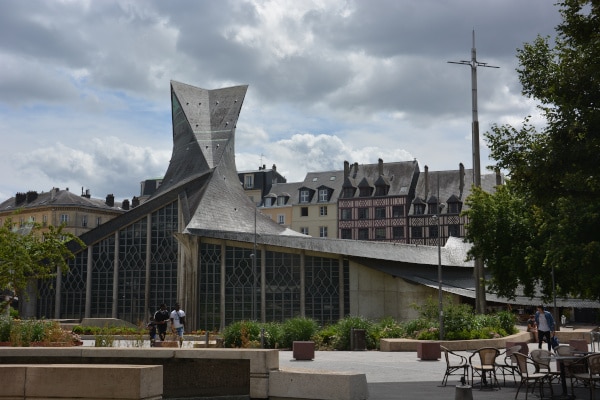
And then there is the Eglise Sainte Jeanne d’Arc. A rather modern building that seems to lie like a scaly dragon on a square between old half-timbered houses. Already on my first visit to Rouen, I had noticed this church building and actually it remained the most lasting memory. This time I came from the other side into the center and had to search for it. I almost wanted to dismiss the memory as a spook that had eaten its way into my memory over the years – but then I found it again.
The center of Rouen was very busy on this Sunday afternoon, despite Corona regulations. What was absurd and rather unpleasant for me – in the region all public toilets remained closed because of Corona! I don’t know what this is all about – for me it was rather strange. The last time I saved myself to the toilet of a fast food chain, although there were ushers with hand spray and mask next to it, also because of Corona.
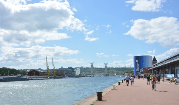
My first track Longwy – Rouen ends in Rouen. Now I have loaded a new track on my Garmin: Rouen – Roscoff via Mont Saint Michel, in the version „with D-Day beach„, 530km. Somehow I find it motivating to meet the channel coast near Caen. This coast is clearly visible on general maps and makes the distances e.g. from Luxembourg clear. Besides, I have been there before, with a „key – experience„. But of it another time…
In the late afternoon I get my luggage from the hotel, sit on my bike and follow my new track. At the end of June it is still light for ages, so I can use the evening well for a few kilometers distance from the big city. At first I always follow the Seine on a flat track. This makes huge arcs in northern France. Just behind Rouen it is already navigable for smaller ocean-going ships. That is why there are port facilities on both sides of the river. The first villages are rather street places with only one-sided residential buildings, on the other side are warehouses and port sections. At the end of the first bend of the Seine there are meadows, small woods, a chateau and real villages. And I have to go to the other side, because I am still east of the Seine. My track shows me a ferry. This ferry has a lot to do on this sunday evening. A lot of excursionists are on their way with cars and wait in a long queue to be brought to the other side. I drive a little further along the shore path – it’s the sunny side – and have my dinner break on a bench milled from felled poplar.
When I want to take the ferry, I am strictly addressed. After some gestures I realize what the guide wants. Balancing the bike with one hand, I pull my face mask out of my pocket. After all, it’s public transport, so masks are mandatory in France, too. Since the drivers next to me don’t have any on, it hadn’t even occurred to me.
After five minutes I am on the other side of the Seine in La Bouille. There I have to drive a little further along the river bank, which is very busy. Then I turn left into a small side street – and really hard uphill again. I don’t even try for long – I push. Two cyclists are catching up from behind – teenagers, who crank up the mountain with unloaded mountain-bikes. They have to pedal so fast in order to move forward that I get a heart attack just watching them. This is easy, but I find it too strenuous for my circulation. Because I like it more to pedal slowly but with power. But if the mountains are too steep, it doesn’t work, then I get off the bike and prefer to push the piece upwards. It’s slower, but it’s not that bad – I sit up, my body can stretch, my legs and all my muscles make a few other movements… In the end, I do get something out of it.

A while later I am also on top. Western bank of the Seine, the valley just behind me. First of all there is a plateau. Relatively boring – fields, pastures, small villages… quite open country. In between I meet a few highways that branch off here. My way lies a few kilometers next to them. In the evening heat I thirst for a beer. When I discover a highway rest stop, I try to get in. Unfortunately, everything is surrounded by stable, high fences. That’s quite new to me – years ago I often visited rest stops on my tramp tours on French freeways, because you can get away from there very easily. There were always loopholes in the fences. A few meters further on, at the parking lot, there’s a piece of fence with a trail. I lock my bike outside behind a bush for cover and go to the gas station. There are a lot of things there – but no beer. Right, French freeway stores don’t sell beer! Well, as a „substitute“ I take a liter pack of milk with me. And my breakfast baguette. With this short-lived additional freight, the bike tour continues until I find a place to camp.
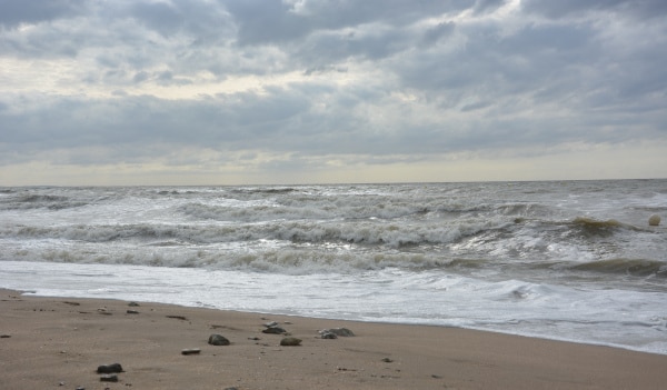
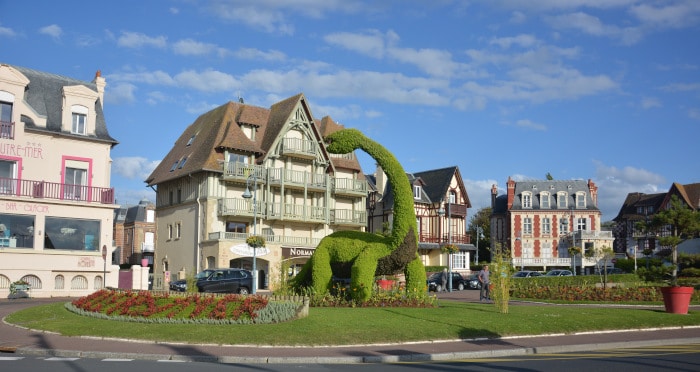
The next evening I reach the coast at Villers-sur-Mer. I take a few photos on the beach and roam the streets. There are some tourists on the way in the evening sun, but relatively few for the end of June. In a green area behind the beach promenade there is a huge dinosaur, about 8m high, made of green plants between flower beds. There are also many flower boxes and hanging baskets in the streets. But in France this is by now a quite usual sight. In the restaurant – outdoor seating is life, but many houses are closed. The search for a night camp is a bit tricky. A bit outside of the village I find it on an overgrown, abandoned property. However, I have to push the bike over a rampart where a small path goes over it. Thirty meters inside, there is a clear place for me between crooked trees and rampant blackberry bushes. Since the weather here on the coast is changeable, I also stretch my tarp over the whole thing. So I spend a quiet night in this remote place.
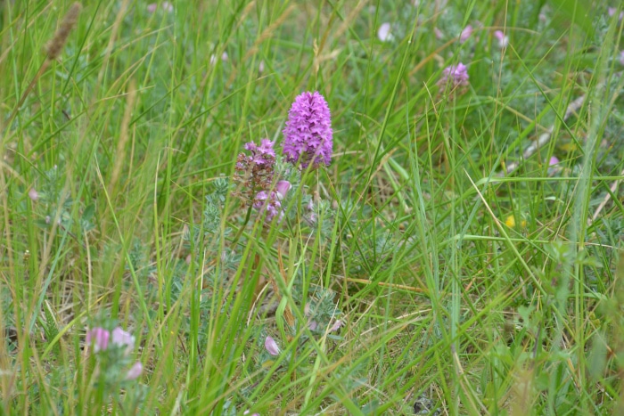
In the morning the journey continues in southwestern direction – always along the coast. Houlgate, Dives sur Mer, Merville – Franceville Plage. Then comes a nature reserve which includes the mouth of the l’Orne river. With nature reserve station „Maison de la Nature & de l’estuaire“. There, students are just about to inspect the display boards.There are several groups of seats a little further away. On one of them a family has already started with their picnic basket with breakfast. I lean my bike against a tree and set up my breakfast utensils on the table next to it. After the refreshment I look around in the area. Orchids and other species grow on the wet meadows. A few rounds with the camera complete my photo collection. From the marsh meadows behind the beach two women with spotting scopes and tripods come. Apparently there are also observation stations half embedded in the ground at several places. A bit further, already at the river arm, there is an observation tower. I have to go up there first. In spite of binoculars there is not much bird life to see at this time. But I can look over the wild arm of the river Orne to the lighthouse at the exit of the navigable Orne channel. It is quite close, but to cross the canal over a bridge I have to drive almost 4km south. Then it goes over a lift bridge to the west side. Unfortunately I did not see a bridge opening, but the construction looks like the bridge body is rolling backwards on huge wheel quarters, lifting the roadway like a big clock hand.

Right next to the bridge there is a museum about the Normandy landing. And the commemoration of this June 6, 1944, the „D-Day“, will accompany me for the next few kilometers. Because this is where the landing beaches of the invading troops are.
Along the canal I am now heading north again. The path runs dead straight next to the watercourse towards the ferry port, which lies directly at the mouth of the canal. In the bushes next to the canal I see some black-skinned people living in temporary tents, one is washing his shoes in the river water – obviously refugees hoping to find a loophole at the right time to take the ferry to England.
The ferry port is now fenced in with 5m high, quadruple barbed wire fences and lots of cameras. It wasn’t that drastic when I passed by here about 17 years ago.
The picture in Ouistreham is similar to Villers sur Mer – moderate vacation business, only a part of the gastronomy is open. At one of the snack stands I take the opportunity for a 4-cheese sandwich. Then I stroll back to the beach promenade where a stiff breeze blows the sand over the paving. Everywhere I go, not only the typical atmosphere of a seaside resort can be felt, but also this special feature of the landing zone of 1944. Several monuments honor the different landing troops, whereby the backpiper William „Bill“ Willin is the closest to me personally. A musician, actually in the service of joy and pleasure, who here takes part in the military conquest of a coastal strip and with his music is supposed to cheer up the fighting morale of the shaken, bleeding, dying comrades. I can almost hear his music in the midst of machine gun salvos and dying shells.
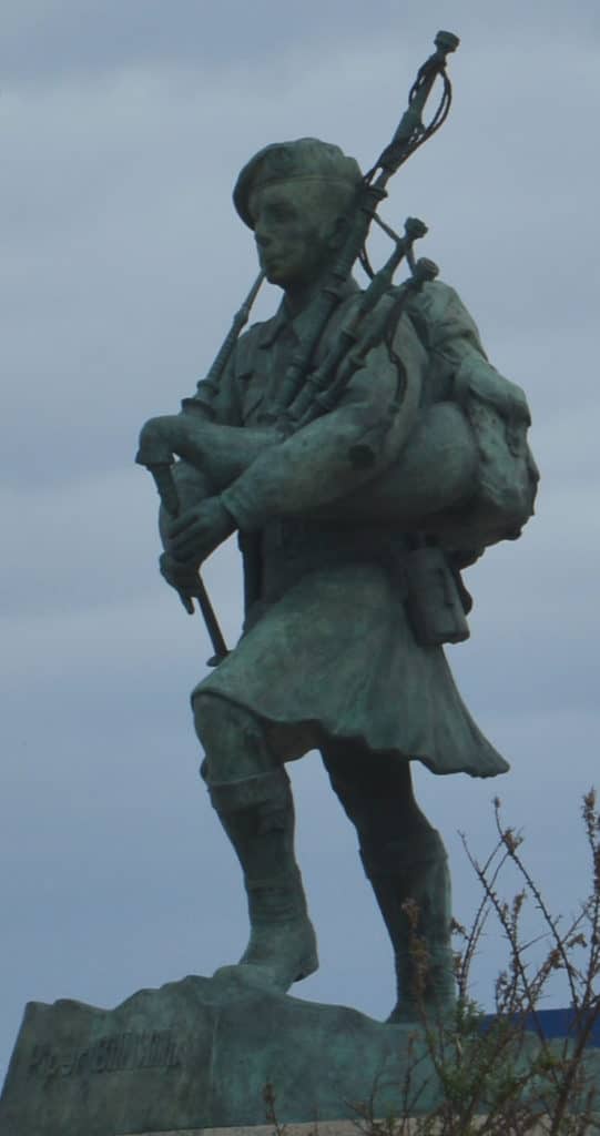
At the Bagpiper Monument I leave the coastal region and turn southwest to cut off the adjacent Cotentin Peninsula. It is afternoon, the last day of June, and the streets are quite busy with rush hour traffic from the city of Caen. Unfortunately I have to drive around the town first, always somehow stuck between the commuters and the tractors. In addition there is of course the wind – once again from the front. The rear landscapes of the Normandy coast are mainly agricultural – there are only a few small woods and not too many hedgerows in this corner. Open country thus, easy play for the wind. Only towards evening the traffic calms down – or I finally reach the more remote roads.
This is the region of Calvados. An apple brandy, which in the past probably every farmer distilled himself in the Normandy. Only since the 1950s has the cultivation and production been strictly regulated and the designation protected as a trademark. I have never tasted it before, I am not a friend of hard alcohol and no opportunity has arisen. So, not having to buy a bottle, but taking a few sips from someone. The Calvados reminds me more of a book – „Arch of Triumph“ by Erich Maria Remarque*. That was on my father’s bookshelf and I read it rather than the world-famous „All Quiet on the Western Front*“. In the meantime I remember above all that the main hero Ravic lived as a refugee in Paris and often drank a Calvados. Apparently he was good against everything – cold, stomach ache, mental suffering…
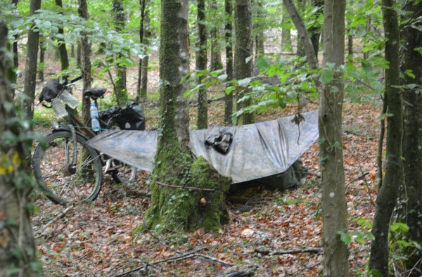
When I hit the first piece of forest, I decide to continue for a few more kilometers. It’s too open in the landscape, and it’s right next to the road. And it is still relatively early in the evening. According to Garmin I find the next forest in about 8, 9km distance at a level crossing. That’s true then. Away from some scattered plots of land I drive along a railroad track and then turn off into the forest area. I stretch my tarp in a young forest that night. Relatively light, but with a pleasant soft cover of leaves, which complements my rather thin mattress very well. Then I enjoy a late dinner and read a few more pages in the eReader.* July begins with a quiet, restful night.
I get my breakfast coffee in the FDJ store in Brecey. I put the food on a bench next to the church, although the street in front of it is quite busy. The village is once again on a hill, the continuation of the journey leads first into a valley. Of course only to present a climb again on the other side. But that is relatively harmless here. At the edge of the village someone shows me „thumbs up“. Just like that – ‚great that you are loaded like this and obviously you are long on the way by bike‚. In the meantime I am quite tanned. Most people greet me with „B’n jour“, but I’m used to that and do it the same way. But some people show more interest and express their appreciation with small gestures. It makes me a little proud, especially since I know how many kilometers and efforts are behind me.
In the early afternoon I am in Ducey. Never heard of it before… And at first I don’t even want to go in, because it’s just a brisk ride on a railroad bike path. It follows the small river Ducey les Cheris. But hunger drives me into the city. And it is really worth the detour. The city has some nice green parks, is located at several rivers and offers surprisingly friendly views with a little castle and pretty old town houses. Unfortunately the through traffic is a bit annoying. Apart from that there is not much going on, the Corona – restrictions probably put pressure on the mood of the inhabitants. But my food tastes good, there are some nice little restaurants with different styles.

Back on the railroad cycle path, I discover a signpost: Mont Saint Michel 12km! Well, I can still make it today! Especially, with such a super – cycle track… But the joy lasts less long than I thought. On the one hand, because the cycle path ends after 4 or 5 km at Rontaubault and on the other hand, because the kilometer indications on the signs are somehow getting wider instead of shorter. But still, just a short distance behind Rontaubault I can see the Michel in its bay. On narrow roads it goes always along the coast, which forms a funnel here, where this Ducey river together with the La Selune flows into the channel.
Sometimes there is also a bicycle path next to the road. Or a path through the marshland, but there I suddenly come out between pasture fences, with wire across the path and barking dogs. That is less pleasant for me. But then again on the meanwhile bigger and busier road.
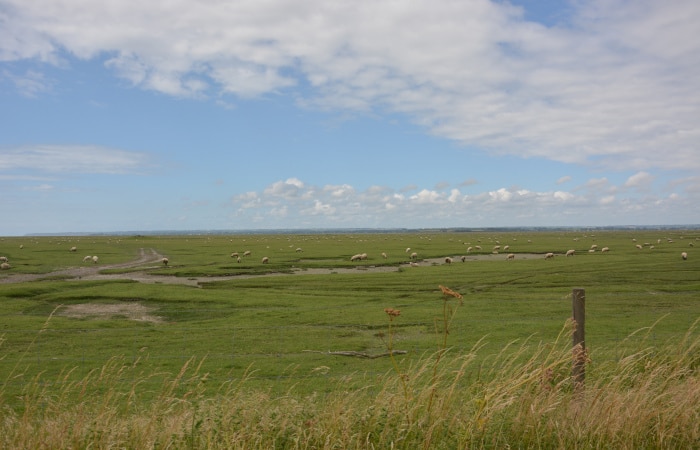
In the end, I reach a kind of „bridgehead“ – huge parking lots, access controls, supply facilities, etc., which are supposed to absorb the tourist rush on the holy Michel. I sneak into the area via a side path and thus avoid the park-and-ride zone.
First of all I park my bike on one of the bicycle parking lots. It is not a company, my bike stands there almost alone. But with all my luggage. I myself go with camera „armed“ to a weir, which separates the river Le Couesnon from the tide. From there I have a good view of the monastery island in the bay out there. A bit behind the weir a stilted road towards the Mont Saint Michel begins through the marshland, which winds in an arc on the rocks. Wide foot/cycle path, road, another strip of footpath… cycle path? voie verte! This is the name of many of the cycle paths, especially the railroad cycle paths: Green track! O.k. from May to September the cycle path is only open from 18:00 in the evening. It is only shortly after four. But I see a group of cyclists who just keep going. And there is not much activity either. So let’s go, at least up to the rocks I can do. I don’t want to go inside today anyway. So I get my bike and set off. Most of the time on foot, I enjoy the view and take a lot of pictures. The bike is a bit of a hindrance. But what the heck, it has carried me faithfully over 700km. It’s beautiful weather for taking pictures, blue sky and sunshine with a few small „decorative clouds“. Of course I want to take advantage of that. There are no dramatic pictures today, with thunderous waves, chasing grey cloud shreds and drifting spray… Rather the postcards – idyll. And I also have some space – there are not too many tourists on the way.
The other cyclists just leaned their bikes and luggage against a rock in front of the gate and disappeared on the mount. I don’t dare to do that, although there are some „patrol policemen“ and sometimes even something like heavily armed task force people sneaking around. I’m sure they don’t care about my bike at all. Or maybe worse, suspicious. So I prefer to just walk around on the outside and save the visit for later.
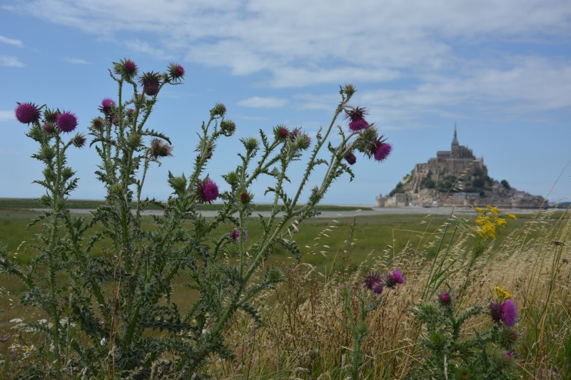
Then I withdraw from this visitor magnet. I have to get something to eat for night and breakfast and then find a place to sleep. I find it at one of the dikes in the interior. „Dyke de la Duches Anne“ – dike of baroness Anne. If that isn’t a rather noble bedroom. Ideal with an easterly orientation, which protects from the strong wind from the sea and brings early sun. It helps me tremendously to get up in time. I even have a suitable stick to support my bike! As if someone has prepared my sleeping place. I stretch the tarp from the bushes on the embankment. On the other side corn is growing. High enough that nobody can look over it. A very quiet place and practically directly at the cycle track. Now I’m confident that I can make the „few kilometers“ to Roscoff. With the view of the map of France I have already drawn quite a line through the landscape. Tomorrow I will probably reach Saint Malo.
Continuation from St. Malo to Roscoff, part 3 of cycling through the north of France
