By bicycle through the north of France – Part 3
After a quiet night in the lee of the „noble“ dike I wake up. No, I did not dream of the baroness who donated the dike. It is already light and the sun has already climbed its way a bit. No wonder, in early summer the nights are short. But so far everything is quiet, on the cycle path up on the dike only once or twice cyclists have passed by. In all peace and quiet I pack my 7 things together and push the bike back up again. Then my day’s stage begins, further west along the shore of the extensive bay of St.Michel.
[Contains *advertising]
Continuation of „Cycling in France“ Part 1 and Part 2
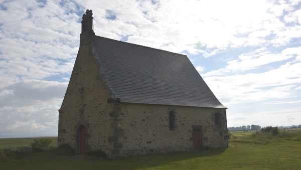
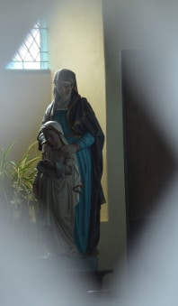
After a few kilometers on the dike the tree population ends with poplars and the now wide dike top is openly covered with lush grass, which is still wet from the morning dew. On the sea side there is a small chapel, but its doors are locked. Only small ornamental openings in the doors allow a view into the interior.Opposite lies a pond, on which blazerails swim. After closer observation I also discover some little grebes and try to take pictures of birds, but the distance is too big for good pictures with my usual zoom lens. At the bike path there are some picnic benches and I use the opportunity for my morning „energy breakfast“.
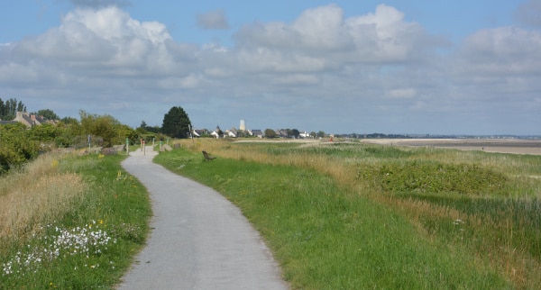
And on and on it goes along the dike, which is now much flatter. The earth wall rises only about 1.5 m above the wide marshland, which extends northwards to a barely perceptible sea seam. After a few kilometers I come across the first houses of a long village on this coastal strip, Cherrueix. Only at the church there is something like a small village center, as usual with Mairie, a small corner store, a closed restaurant and a post office. But new are the „Breizh“ souvenirs in the store. Small pennants and flags, baseball caps, T-shirts and beach towels with the Breton black and white stripes with mill wings – the symbols of Brittany. In the street behind it a „beach access“, next to it a small snack restaurant. Here my petit morning coffee costs 1,60, usually 1,10 to 1,20 are usual…
I can already see the coastline here until Cancale in the northwest – the wide arch of the bay of Mount Saint Michel stretches out flat in the rising sun. Actually my track cuts this peninsula off from St.Malo and leads in southwest direction across the bridge of Port St.Hubert. But somehow I have a romantic idea of St.Malo and I would like to go there. It sounds like an old pirate’s nest, no idea where this idea comes from. So, somewhat lost in thought, I simply follow the coastal path towards Cancale. Here, other cyclists with luggage often come here – I never had that on the whole 700 km long route from Luxembourg. Besides, I even see some long-distance hikers with backpack and guitar on the path along the shore, who follow the path along the shore just like me.
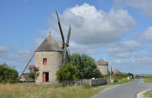
At Le Vivier-sur-Mer, on a wide asphalt road on the beach, I see large amphibian vehicles that look like big ships but roll on thick tractor wheels. I don’t know much about them, but I think they are crab fishermen.
The weather is fine, the sun is shining, there is some wind (as always from the front), but it still works. Slowly I get closer to Cancale on the flat path around the bay. But there I have to climb up a hill and the nice bike path ends. There is nothing left for me to do but to take the busy road for a while. Then I discover a side street that brings me closer to the coast again. On a panoramic parking lot there is already a lot going on, some are having a picnic. But for me an exclusive first row – bench becomes free. I use it for my break. From there I can look out over the bay and also have a look at Cancale. With my small binoculars I study the city view with the main street and fishing port – and decide to do without a closer visit. The place doesn’t seem that interesting to me from a distance. After all, St.Malo is tempting, and that is on the other side of the peninsula. So after the rest I ask my Garmin for the best way there.
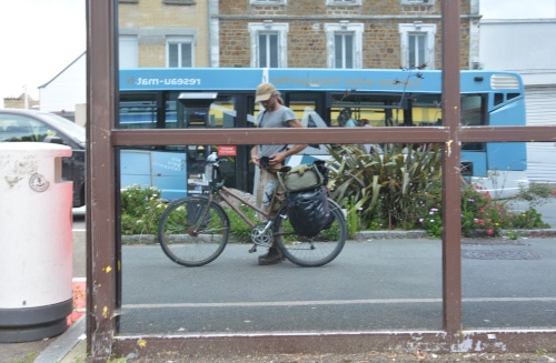
Unfortunately, it goes up half the mountain again and then across the headland. Shortly before Staint Malo I can already see rugged rocky bays, islets and blue sea arms. Everything just as one imagines a pirate hiding place. From the north I enter the city area. Here there is already a bigger beach, which reaches directly to the last houses. At a snack stand, which is frequented mainly by beach visitors, I buy one of the crepes so popular in Brittany. Then I drive, unfortunately over quite busy streets, further into the citycenter of Saint Malo. From Corona – protection is not too much to see – the streets are busy, many people enjoy the sun. In front of restaurants there are large outdoor seating areas – all full. Waiters walk around with face protection, otherwise hardly anyone wears a mask. Only the beachfront path now has a dividing line and „directional walkways“ marked with arrows.
The city of Saint Malo is located on a beach island and is enclosed by the sea to the west and several harbor basins to the east. Between the harbor basins there is a free space, the Esplanade Sant Vincent, which I reach first. There, in a glass pavilion, the tourist information is located.
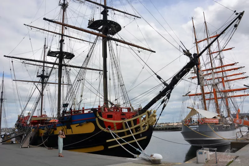
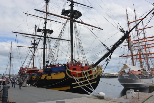
In the port there are several yard sailers moored. I take a look at them first – the „Etoile du Roy“ and the „Le Francais“ as well as the „Le Renard“. The sight of the ships immediately brings over the atmosphere of the old pirate – Nest’s.
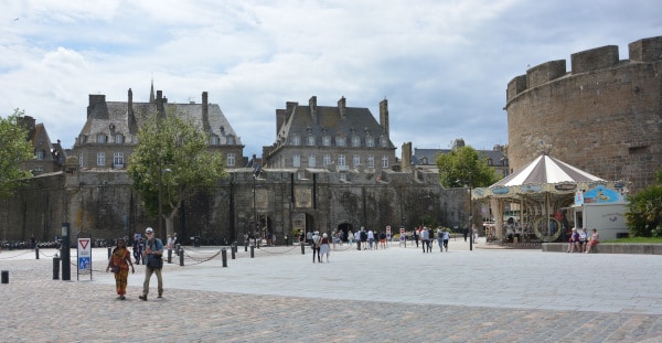
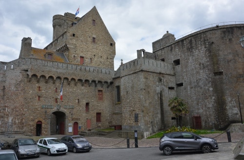
Across the square you can see a city wall or an old fortification wall and fortress-like buildings, and the only way into the city is through a narrow, solid gate. Access is also strictly regulated, with two guards stopping cars trying to enter and letting only a few authorized persons through. Below the city wall there are a few palm trees and a large plane tree, providing fresh greenery, so that the defiant walls do not look quite so bleak and daunting. These walls are overlooked by the rows of windows on the upper floors of two houses, above which still typical steep roofs with mansard windows blink. The view is rather promisingly inviting.
A fortress-like buildings of Le chateau de Saint Malo house the „Hotel de Ville“ (town hall) and a museum. Unfortunately this is closed because of Corona. Otherwise, around the inner square there are hotels and restaurants with large open-air seating, and there is a lot going on everywhere. I lean my bike against a bench in the shade of two trees and sit down.
I haven’t had such a busy place for a long time. The sun is shining and the atmosphere is very pleasant between historical walls, under early summer green and with so many vital people. From my bicycle bags I take a few „Barres“ – chocolate bars and a milk bottle. With instant cocoa from my big can I mix my chocolate energy drink. Some young girls watch from the free seat of Le Chateaubriand and find it very amusing. Families pass by me with their children and dogs. A few tourists come along the street with their suitcases and disappear in one of the hotels. From the Place Vauban two convertible – oldtimer – sports cars approach and drive towards the city gate, attracting the attention of most of the bystanders.
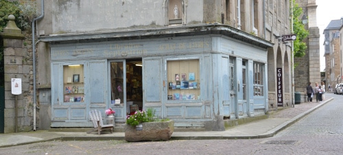
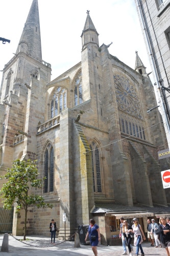
So I remain sitting quietly for some time and look at the lively scenery around me. Pushing the bicycle, I later start a visit tour through the Saint Malo center. Interestingly enough, I see a few streets further on that the buildings are by no means very historical. Although built of local natural stone or at least faced with it, the facades above the store level reveal modern architecture. The windows and the whole design are very regular and indicate a rather industrial prefabrication. This disappoints me a bit, but nevertheless the streets here are well populated. It is more of a shopping mile than a historical center, apart from the Cathedral of Sant Vincent, around which the neighborhood is built. On Place Brevet, an old bookstore with a somewhat weathered wooden façade looks as if it has fallen out of time.
A few streets further on, school has just finished, and there is not much left of a „traffic-calmed-down neighborhood“. Rather, it is typical that too many parents with too many cars fight over the too few parking spaces to pick up their lazy children in front of the school gate.
At Porte de Dinan I leave the quarter for the time being to have a look at the harbor basin in front of it and at the fortification from the outside. From there, some ferries go to smaller offshore islands and to other neighborhoods in the south of the Saint Malo city center that are cut off by the harbor and the river mouth. A lift bridge is sometimes opened for ships leaving the port, which causes a long traffic jam on the adjacent ring road Chaussee Eric Tabarly with honking and scolding car drivers. So I prefer to retreat for a while into the calmer alleys of the old town quarter.
In the late afternoon I have enough of sightseeing in Saint Malo. After all, I want to get out a bit and make a few kilometers.
There are only a few streets between the different harbor basins. But then I will have to move on to the more lively quarters. Unfortunately, the main roads are as congested with cars as the pedestrian zones were full of people. With the help of the Garmin GPS I look for a good connection back to my gpx-track to Roscoff, which runs a few kilometers south of Saint Malo. And then it demands patience to get out of the city through the crowded streets and find less noisy ways.
Finally I succeed and roll in a southwestern direction through the hilly landscape. On the west side a kind of fjord, the La Rance, stretches far into the country. Sailors are still out there in the evening. On one bank there is a kind of mill or distillery, a building made of natural stone. This looks very much like celtic styles.
In the evening sun I reach the small village Saint Suliac south of Saint Malo, which shines warm and reddish with its grey-brown stone houses. Blue, gray and burgundy red shutters as well as green-colored flower bowls provide color accents. A creperie „Au Galichon“ is waiting for guests, therefore is a table and a few chairs at the roadside. The streets are rather narrow alleys and sometimes steeply sloping. Halfway up, there is a chunky stone church with a thick tower, whose gilded clock face shines in contrast to the dark stones. Further down the road ends at the fjord La Rance – I must have missed my turn-off again. But never mind, the place is beautiful, especially at this hour of the evening, not very busy and yet somehow atmospheric.
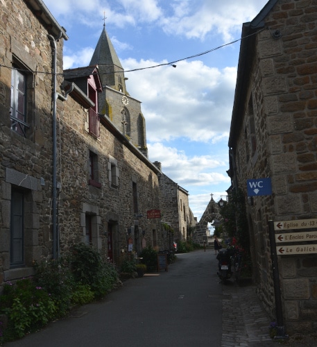
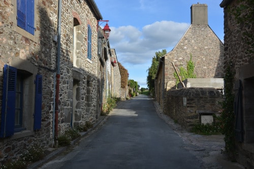
When I turn off to leave the place, it goes uphill again. I don’t want to go far today. On top of the mountain there is a big mossy stone cross with the crucified one, which is painted brightly. The crest of the mountain is wooded on the southeast side and I look around for my place to camp for the night. But that’s nothing – the forest is partly parceled out and belongs to inhabited properties, even if the buildings are further down. On the west side of the mountain, over which I just pushed my bike up, there is an extensive corn field. Some of the vegetation has just been planed off at the access road to the field or a cable has been buried there for a few meters at the edge of the field. Now I push my bike over it until I find a quiet, secluded spot between the field and the hem hedge. There I will camp this night.
For a long time I sit relaxed at the edge of the field and read in the eReader. At the beginning of July it is light for a long time. Across the corn I can just about make out some of the roofs of the village. All around me swallows are hunting for insects. It’s really exciting – they fly at high speed deep in the gap between the corn and the hedge, come straight towards me and just make a little detour around me, over and over again. Then they use a different course – probably because the yield at the hedge is exhausted at first. Later they change back to the hedge hem – course. They do this until it obviously gets too dark for them too – after that everything remains calm.
When the sun has disappeared from the horizon and night falls, I stretch out in my sleeping bag on my mattress. The tarp is beside it, but the way the sky looks, it remains cloudless and dry. The first stars appear above me. I like this life on the road. I am quite exhausted in the evening, but I still discover something new every day and I am happy about the beautiful, varied landscapes, the cities and the people who live there. And the bike makes me independent. Satisfied, I turn on my side and fall asleep.
The next morning an old iron bridge comes, on which I can cross the now narrowed sea arm. Later, after a few kilometers of „pre-breakfast route“, I find a particularly beautiful breakfast spot. Next to a bridge there is a small picnic area on a meadow with a roofed seat. A small river flows leisurely by, everything is surrounded by trees through which the sunlight floods. My beer can – spirit stove provides a hot coffee and on the baguette there is, as always, energy-giving honey and „cart grease“. A robin comes to visit and watches me for a few moments. On the opposite bank of the river a muskrat swims along and disappears into a small cave. On the road, cyclists chase by a few times, all dressed in colorful racing driver costumes. The track is part of a designated bike course.
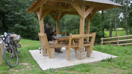
I take the opportunity to dig out an open-end wrench. With it I can tighten the saddle cloth of my good Brooks saddle*. I should have done this long ago. The leather stretches a little bit and the seat starts to sag more and more. Then the frame wires are pushing through. But freshly tensioned the saddle cover springs and makes the pedaling much more comfortable. The chain gets a little oiling again. Later I find a gas station with air pressure – dispenser. Many gas stations in France are department store stations or tiny single-column stations in the countryside. There are rarely air pumps. My Schwalbe Marathon – Tyres* need a pressure between 3 and 5 bar. This is hardly possible with a hand pump. With 4.5 bar freshly inflated, the wheel rolls twice as well!
At Yffiniac I reach one of the tidal influenced bays, the Baie de Saint Brieuc. There is nothing to see of the sea, but the wide expanses of the marshland turn into sandy zones. My way leads me first along the shore. There is quite a lot of excursion here – traffic on the way, cyclists, pedestrians on the shore path, but also motorcycle gangs. A former railroad depot with a few meters of track across the path and a switch system make me curious. There is nothing else to see of railroad facilities, but the depot is a small railroad museum (unfortunately closed like so many things). It turns out that the riverside path or at least a part of it is a former railroad line. It leads to St. Brieuc, my next city thoroughfare.
But now it goes up the hill – and down again. Only to reach the entrance of St. Brieuc via another ascent. The dismantled railroad leads some hundred meters beside the road over an impressive viaduct. Unfortunately a little bit ramshackle… And then just before the town, a second viaduct, which the road crosses under with a serpentine. My bike course deviates from the former railroad line, but as I cross a valley on a bridge in the town, I think I can guess the old railroad line again, which is probably fighting its way out of the valley on a slope. And up there is a building that looks like a former station – reception hall to me. But I don’t know if I’m right – I don’t see a clue, an information board or something similar. I will probably do some more research at home…
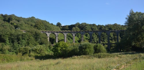
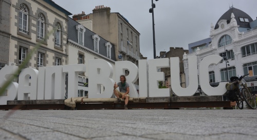
In Saint Brieuc there will be a square first with a city name like the ones that are now being set up everywhere for advertising Insta photos. Well, I take the opportunity – how many people before me have made the distance from Luxembourg to here by bike?
Then I discover a closed city information center and an equally closed theater. In general, everything here is pretty empty. Okay, it is Sunday. A sign leads me in the direction of the „historical old town“. But I am not really carried away by all this. It looks more like a shopping mile in closed Sunday rest, with security shutters down everywhere.
Slowly I am getting hungry again. After trotting through several streets with closed stores, I find a kebab man at the end. He seems to have something vegetarian on offer (in France this is not a matter of course). Only, before that I have to pull a few bills at a bank machine. So I remember where the Dönerman is and start looking for a bank machine. In the end I arrive at La poste. Enter my pin and then the usual amount with which I get a stock for about 2 weeks. But then the pin question follows again… that confuses me. Maybe I’m a bit hypoglycaemic… in any case my security in terms of my pin is gone all of a sudden. „The process was aborted“ I try again. Again I get the pin-query twice – ‚is this the third wrong entry or only the second? In any case I abort now just in case. What’s still missing is that the card is pulled in by the machine at the end! This actually happened to me once, was a machine error. It took two weeks – over Easter – until I got a new one. Maybe this card is not yet blocked here and then I can try again later or tomorrow, when the secret number is clear in my head again.
But now I only have 1,80€ in my pocket. Do I have money hidden somewhere? No. How do my supplies look like or when does hunger begin? Well, I’m almost always hungry on tour. Or just a feeling… My body got used to the size and rhythm of the meals. But energy requirements are always there on such a bike tour. Even my little beer belly (or rather office belly), which I have grown in the last years, has almost disappeared. Okay, I still have half a baguette, some cheese, a bag of noodles, oatmeal, couscous … to drink water. So, supplies for about 2 days. Well, then I will try again tomorrow with the menu. I’ve had enough for today. … and the kebab man from St. Brieuc is unfortunately cancelled.
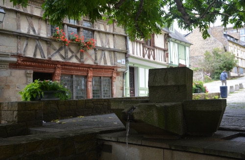
In the meantime I have found something like an old town quarter. It is not very big, but actually quite nice. With a gray church made of hewn natural stone, some houses, whose first and if available second floor was built in half-timber, colorful shutters in contrast to the gray natural stones… I take some photos, but today I am only halfway through the story. From time to time the financial problem comes to the fore. More or less I decide to get a second credit card as soon as possible – just for security. So that I don’t have to sit somewhere in the world again and have no more money in my pocket. On the other hand, sometimes the thought comes to my mind, yes, if you really can’t get hold of money now, how do you deal with it? You will then inevitably have to try to get food from others. Possibly against a job, or somehow different… exciting.
The next day I reach Bourbriac. It’s a little bigger and has a branch of Credit Agricole. There I try my luck again. In the meantime I am sure again with the PIN. But damn it, the credit card is blocked. So I take my rarely used mobile out of my backpack, turn it on and dial the service number of my bank. Endless queries of a machine voice. It gets longer every time before you can really talk to a person. When all other options are exhausted and I finally answer YES! to the question „Would you like to talk to an employee now“, there is … a waiting loop … „unfortunately all seats are occupied at the moment“.
All right, the lady finally tells me that there is a „PIN error“ noted and asks me a list of questions to prove my authorization to release the card. Then the card is unlocked. Just fine. This time I get 100€ emergency money in addition to the two-week budget, which I will not touch…
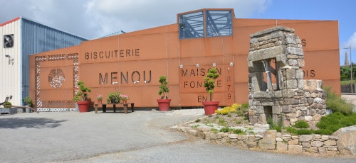
Later it goes again miles over land. I have my lunch in the „front garden“ of a biscuit factory in Plougonver, which has also built a museum. But like all regular museums in the world, it closed on Monday. The museum building is a rusty steel construction, in whose walls the inscription and a „biscuit pattern“ was cut.
The tour continues, again through hilly landscape. So, downhill, over a bridge, around a curve that slows down the fast ride, and then up again over there. The architecture has changed a lot since Rouen. Most of the houses here are solid stone houses from hewn quarry. Half-timbered houses are rather the exception. The bilingualism is also striking. Almost all signs are now in French and Breton. The place names seem to be borrowed from another language that has little to do with Romanic roots. After two weeks in France, this doesn’t feel so French anymore. To me, at least, it all seems a bit „transformed“, with a character of its own, different from the style of French lightness and colorfulness I have experienced so far. So – in no way unpleasant, but somehow different.
One of the typical smaller towns is Guerlesquin. This town has long outgrown its historical boundaries. But the city center consists mainly of a large ring of streets. This is a long drawn-out street on a slope. In the lower arch is the grey stone church with a wide, not very high nave and transversal wing. The chancel forms a trapezoid in plan and is closed to the east by a large window rosette. Above the west gable, which is situated uphill, there is the bell tower. In three round arches – openings hang the bells freely visible – two next to each other, the third smaller one centrally above the other. On the south side of the tower there is a smaller round tower, which reaches up to about the height of the large belfry. It looks as if this contains a spiral staircase that leads up to the main tower to the bells.
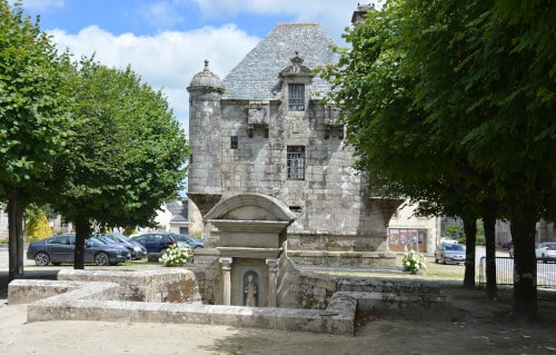
Around the ring road there are small, certainly very old stone houses. These are also built of hewn quarry stones. At least the window lintels are partly chiselled again or the windows are set down. In front of the houses there are still flowerbeds on the northern side. On the square in the ring road there is the church, the „Mairie“, the mayor’s office and a somewhat strange looking tower. This tower is approximately square in plan. The main part could even be a cube, which sits on a pedestal and is closed by a steep hipped roof. At the four corners of the cube there are round oriel turrets. The strange building has quite few windows – actually, apart from a few small hatches, only two on top of each other in the middle part. One is practically in the middle of the side square, the second one above it, so that it already forms a kind of mansard window for the roof. To the left and right of this window, there are two square extensions under the eaves, which look like pitchnoses – or the latrine for the upper floor? On the south side there is also a rather huge chimney construction. Since I haven’t found a proper explanation for this building, I can only think of two possible functions in view of the few high windows: Prison or safe tower.
In the middle of the square there is a captured spring. Two city officials fill their watering cans in it and supply some flower boxes with water. Otherwise, the upper part is a parking lot shaded by trees. The lower part is a nice little park, which I use for a break.
West of Guerlesquin my paths suddenly become narrower and narrower. This looks more like a driveway for a remote vacation camp or something. But garmin says I am right. My track turns to the left – onto a narrow, washed-out path that goes downhill a little beside the fence along the edge of the forest. When the track dives into the forest, I stop and lean my bike against the slope. Because now it gets really steep, I can’t get back up once I get going. I couldn’t even turn around in the narrow hollow. So I walk a few meters into the path to see if this is the right track. But it seems to be right…
Well, once again really adventurous! With the brakes on almost all the time, I roll down the steep path. The valley now almost turns into a canyon, the path is narrow and covered with leaves. In some places even fallen trees hang over the canyon. It goes deeper and deeper. In between I stop to take some pictures and to allow the brakes to cool down. They need them – my front brake drum is so hot that I burn my fingers. In the back the rubber stinks
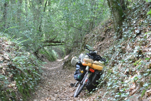
At the deepest point a brook flows again, of course. The path is also flooded and swampy. But somebody has already put some boards over it, so that I get through quite well. Then there is a slight bend to the west and a wider hollow path. Slowly I am through and out of the forest. I reach a property and with it a driveway. This also leads into a road again. With a mixture of enthusiasm (about this great gorge and the little adventure) and relief (managed, survived without any damage and fortunately it was not necessary to turn around) I can start my journey with course to Botsorhel.
Once again I camp for one night on the verge next to a cornfield. But this overnight stay ends a bit unpleasantly. At dawn I wake up because I notice that my sleeping bag is getting wet. Dew has fallen. Quickly I stretch the tarp to save what can be saved. Rolled up I fall asleep again to some extent.
West of Plougonven there is a new bike track „voie verte“. It leads in northwestern direction to Morlaix. It goes fast in the shady morning coolness of this beautiful green cycle track. On a meadow at the edge of the forest there is a tent, next to it two bicycles. So there are others similar to me on the way.
The old railroad passes Morlaix, which lies in a river valley, on an eastern slope. A steep descent leads down into the town. Barely a hundred meters below the railroad track I find a community garden. A wooden house is sometimes used as a meeting place, in front of it a piece of meadow with some picnic benches was laid out. Everything is still orphaned. For me a good place to celebrate my breakfast including coffee cult and to dry my sleeping bag and tarp in the morning sun. So I spread out on the benches. Half an hour later a woman comes, greets me friendly, looks here, digs a little bit there and draws my attention to a double socket outside the house where I can charge my equipment. Then she goes into her own garden. The first time in France free access to charge electricity to my laptop! Just like that, unasked! I use that of course.
It’s a beautiful morning – the sun shines down warmly from the blue sky, my sleeping bag is dry again, I have had a good breakfast and even my laptop is charged. I could also send some messages and the camera – batteries are full again. Now it can go on.
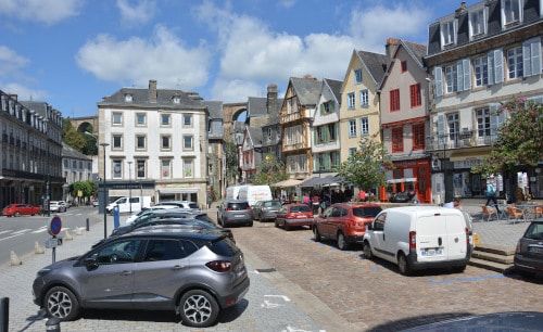
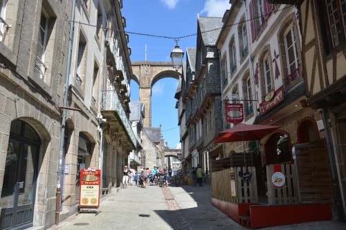
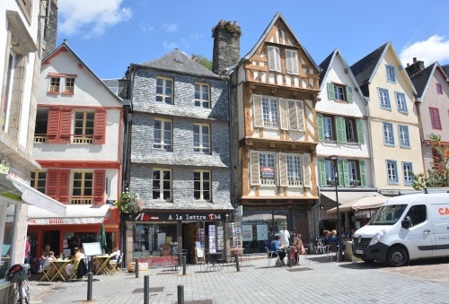
Morlaix turns out to be a surprisingly pretty little town. The town center is located in a narrow river valley and opens to the north to a funnel mouth into the sea. Above the mostly three-storey houses, often with their gables facing the street, the railroad crosses the valley on a high viaduct. Once I even see a TGV driving along there. In the center of Morlaix, I take a few laps through the narrow streets. In the open-air seat in front of small restaurants and cafés, guests sit in the sun. A store – studio offers beach and sea paintings in oil on canvas with rocky coves, bikini-clad backs on sandy beaches, parasol collections and sailing. Main colors are white and blue tones in all pastel shades. Several creperies compete for the sale of the Breton specialty. Some sacred buildings set architectural accents. Tourists are on the move, some with small backpacks and sun hats, others even with loaded bicycles. Here it does not seem unusual to make long-distance bike tours. Towards the north the course of the river immediately forms a harbor. On both sides of the river are boats, mostly sailors.
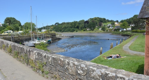
But I have to leave the river valley again on the west side – the way to Roscoff is along the bay only from the next river valley. A long drive up I follow an arterial road upwards. Here the buildings are more modern and housing estates follow. Then I drive a bit parallel to an expressway, which I can only cross on a pedestrian bridge. On the other side are shopping malls and shoebox – hotels like Formula 1. A little bit I have problems to find my track – it seems to lead through a private property. In the third attempt I decide to take a small path which brings me safely back on my route. In the side valley I have to cross a highway once more, then it goes over a ridge and down into the last big river valley. I hunt down the mountain road and cross a stone bridge that crosses the river, which has largely dried up. It is probably low tide again. In the mud on the bank a few sailboats are stuck with their keels. This funnel mouth stretches about 8km into the land!
On the road west of the river I make fast progress. Now I often meet other cyclists, but mostly those of the sportive kind. The route bundles three recommended bike routes and is quite popular. It’s fun to discover this landscape, obviously influenced by the sea and the tides, under a blue sky. The destination, Roscoff, now seems to be within reach.
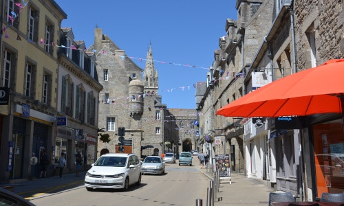
But before that comes a small town, which I had not expected: Saint-Pol-de-Leon. My first impression is that it must be a monastery foundation. The towers and the nave of two larger churches stand out above the city silhouette. Before I reach the city itself, I drive along between the walls of monastery properties. And the main square is dominated by the churches, less by secular buildings.
Apart from that, the place seems to be quite respectable, but a thoroughfare cuts through the center. And the noisy traffic disturbs the atmosphere of the center sensitively. Since it is early afternoon, I am looking for something edible. A creperie offers very good hearty treats with cheese. The preparation takes a little time, so I can walk up and down the main street again. Because of Corona – measures there is only take away. For dinner I sit down on a bench at the church square. Afterwards I go on my way, I don’t like the traffic noise here at all. And finally it is not far to Roscoff.
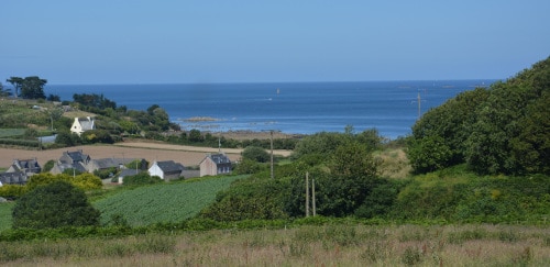
Although I keep on cutting an obviously disused railroad line, the cycle path route crosses the landscape sometimes to the left, sometimes to the right. So the last kilometers are quite long. Furthermore, the headland on which Roscoff is located at the northern end seems to be a rugged rocky island – it goes up and down as well. More or less the whole section seems to be loosely populated, in between there are mainly smaller fields with vegetable cultivation.
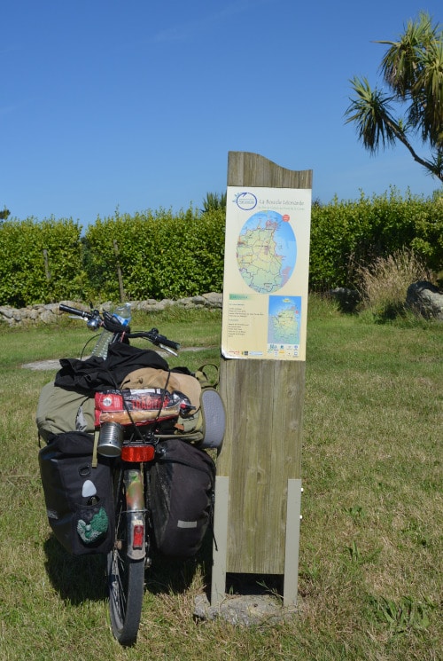
Finally I reach Roscoff… or Rosko as it is called in Breton. And that is directly to the ferry terminal. That’s also where I go first. I want to know when the next ferry to Cork in Ireland leaves and check in immediately.
But unfortunately nothing will come of it. As I was told at the counter, Brittany Ferries only takes motorized passengers. So, a motorcycle is a minimum, pedestrians and cyclists are turned away. That was different years ago, but Irish Ferries was the operator. Roscoff is a stage on two international cycleways -EuroVelo 1 and 4. But you can’t pass the English channel there by ferry.
I had checked the Brittany Ferries website before I left, but the result of the booking request was – ‚cannot be booked at the moment, I should call the service‘. I assumed that this was more to do with the unclear and constantly changing rules because of Corona. Since I didn’t know at that time when (and if at all) I would arrive in Roscoff, I was sure that everything could be clarified at the counter…
At first I leave the Roscoff ferry terminal somewhat disappointed. A little bit I think about the fact that in the three days until the next ferry departure I might find some car driver who is willing to take me along. Or sailor, or ….
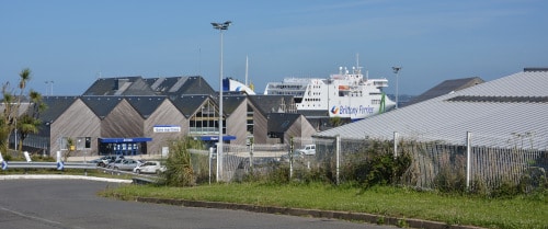
Well, I guess none of this is really a solution. Most drivers today have already booked their crossing in advance and do not arrive at the ferry terminal until the last half hour before departure. And the leisure port is small and remote.
I walk in the direction of Roscoff centre ville. Just above the ferry port there is a casino. It’s pretty unusual for me, especially since the place isn’t such a big city and apart from the few ferries, there’s no big cargo port. But maybe my ideas about Casino and its visitors are simply wrong.
Then the beach bay opens up to me, which practically closes the Roscoff city center to the north. A flea market is just about to start on a large open space. Since I’m hungry again, I sit down on a bench with a nice panoramic view over the bay and the city and worry about my energy supply. So I miss the flea market visit, but I don’t care. In Corona times I don’t like the crowds anyway and I don’t want to push around with the loaded bike. I still look at the leftovers, which are the last to be loaded when dismantling.
At a corner below the Roscoff lighthouse there is an Enfield*, highly polished with British license plate. (*Royal Enfield …a cult motorcycle, built in India) I ask the lady who obviously belongs to it, if the motorcycle was driven here from India. But she denies that. Briefly I tell the story of the British guy from Hampi, who wanted to go to the UK with his Enfield, but he didn’t get around to it in India… This makes for some amusement.
In front of the lighthouse I make some selfies. Anyway – I made my planned bike tour all the way here! From Longwy via Reims and Rouen, the Normandy coast, Mount Saint Michel, Saint Malo to the northwestern coast of Brittany. A thousand kilometers from Luxembourg to Roscoff. I am a little bit proud of myself.
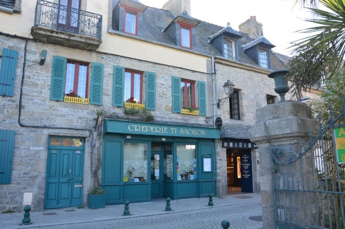
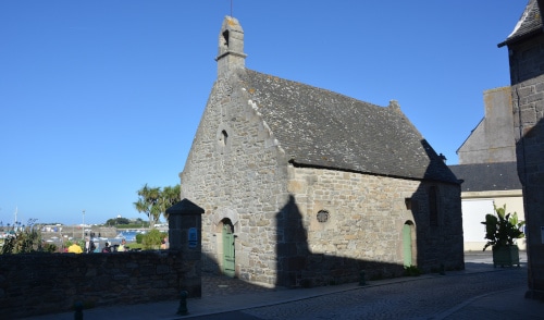
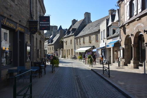
In the evening sun I make a few rounds through the city. Rosko can really be seen! Small stone houses, inevitably several creperies, some hotels and restaurants. The church has a high renaissance tower from 1576, which certainly served as a landmark for fishermen and sailors for some time, when there was no lighthouse. The „Bellfries“ are striking – the bells are again hanging in stone round arches, which form the tower’s skeleton in a quasi free-standing manner. In east-west direction you can look through the tower and see the bells as silhouettes hanging in the arches.
A part of the bay is the fishing and leisure port. A ferry also leaves for the inhabited island Ile de Batz. Several small islets lie in front of the coastline.
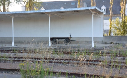
There is a train station in Roscoff, but it is deserted and the railroad line of Morlaix is closed. It’s a pity, a museum train service would fit in well with the port and spa town. Similar to the Usedom-Rail and other spa railroads in Germany, Rosko’s boom as a seaside resort began with the development of the railroad from Paris. Now there is even a forgotten suitcase transport car on the empty platform. But construction is already underway in the area surrounding the station. Presumably, the areas previously occupied by the railroad will soon be covered with buildings. A large part of the station site is currently a parking lot for residents and the city administration, which is also located there. In the busy construction environment and the first new buildings, the old station with its spur track stands in the middle like a relic from times past.

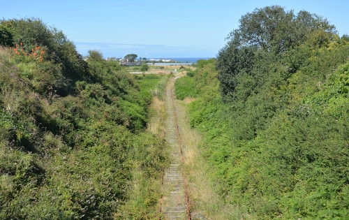
Since I only booked a hotel room* in Roscoff for the next day, I have to find a pleasant place to sleep later. This is not so easy, because the area is a bit „urbanized“. Everywhere are cultivated properties and in between mostly relatively small fields with vegetable cultivation. So I cycle a little bit back along the bike path and stay close to the abandoned railroad line. There I find something suitable: The path leads parallel to the railroad, but it is covered by a thick hedge. On the other side of the railroad line there is a steep embankment and on top the next owner of the land has built a high wooden palisade. Good for me, so I can’t be seen from there either. I push my bike a bit between the tracks and then into the high herbs close to the hedge. There I roll myself enough space to lie flat and have my super-soft, comfortable bed for the night. Satisfied I crawl into my sleeping bag.
The next day I start with an extended breakfast in the harbor bay. Relaxed I watch the city come to life and the people go about their business one by one. A few meters away from me, for example, there is a small outboard motor on the pier with a travel bag and a crate of beer. I wonder what he is up to? Then I see him taking a small plastic boat with wheels at the stern out of a fenced cage – dozens of them are standing upright in there. He’s not going to want to spend the whole day outdoors with it…. Then I realize – the small space-saving plastic boats are only the tenders to get to the real boats further out in the sea. Not a bad idea! That way you save dock and berth in the harbour. Opposite on the pier the fishermen are already active. There are probably some at any time of day – and night…
After breakfast I bring my luggage to the hotel, this way I am „freed“ from ballast and can enjoy the city stroll in Roscoff more.
From the pier a kind of concrete footbridge leads far out in the direction of Ile de Batz. There I go for another walk. Because there you get a view of the coast and the city as if you were out on a boat. There it is also fun to take some more good pictures. On the way back I meet an ambulance with blue light on the pier. At the same time a boat approaches from the sea, more precisely from the island, at high speed. Obviously someone is brought from the island to the hospital. Of course, this is a disadvantage if you live out there – the distances in case of emergency become much longer.
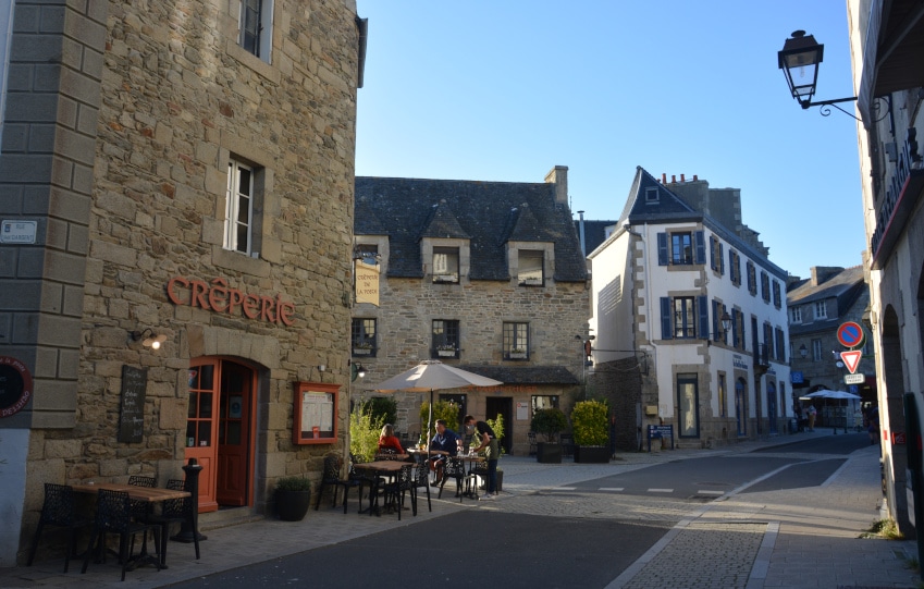
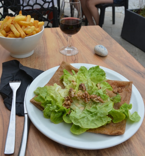
In the meantime, life has returned to the city’s cafés and restaurants. The outdoor seats are quite full, despite Corona. Waiters have a face mask, but otherwise it’s usually pretty crowded. But with „La Parenthèse“ I have a creperie where there is enough space between the tables. And it tastes good, hearty is also a good choice for crepes! (If I like the things otherwise already with sweet contents). Elsewhere gateaus, Breton tarts, are sold. That looks inviting and delicious, but for me it’s enough for now.
Later I visit the Roscoff church „Notre dame de Croaz – Batz„. I have already described the tower. The church was built in the gothic style of the region starting from 1520 as a sailor church. Merchants and ship owners financed the construction. The building was decorated with ship sculptures, which should underline the importance of seafaring for this city.
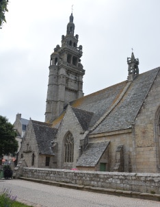
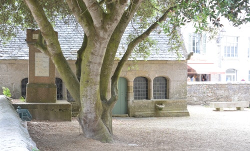
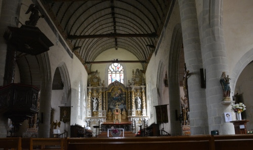
To the west of the church, through some narrow streets away from the hustle and bustle of the tourists, there is an institute of marine biology of the Sourbonne University. Behind it there is a small square with a path along the shore and some benches. There I spend some time with a view of the sea and the island and read a little.
Without thinking much about it, I decide to leave Roscoff the next day. If I somehow want to go to Ireland after all, I have to get into my slippers. After all, the first week of July is already over. The ferry from Roscoff wouldn’t leave until the day after tomorrow, but I probably won’t be able to catch it with the bicycle. So for me it goes backwards now. New destination is Cherbourg in Normandy.
In the hotel I got a new track from maps.openrouteservice.org: Roscoff-Cherbourg_fastest.gmx, 403km. And that’s what it should be – fast through, without much sightseeing or other delays. At noon I have to leave the hotel in Roscoff, and that’s the starting signal for me. The first part up to Mont Saint Michel is almost the same as on the outward journey. Only Saint Malo I leave out of course, that was off the route anyway. And of course I’m not going through the gorge, where it would be uphill this time. Luckily I marked a waypoint there and noticed in time when the turnoff came to the beginning of the gorge path. My alternative is a bit further, but on paved roads and less steep. This way I practically halve the time – I sleep twice at campsites, where I have already been on the outward tour. But in between there are two more sleeping places, which I simply skip. Or better…overcrank. Only when I leave the bay of St.Michel my new track turns north – first unknown station is Avrances. There I at least have a look at the city center – which is also located on a mountain above and is quite exhausting for me. And then it goes northwards – again over many small roads, uphill, downhill. Sometimes a bit left, then right again, but mainly off the beaten track. At the end I come once again on a „greenway“ railroad cycle track. At the beginning there is Cherbourg with 70km on it and it goes fast forward. Finally I almost have to brake, because in Cherbourg in the evening I don’t know where to go. But some kilometers before Cherbourg there are forests. The first ones are obviously extensive hunting grounds – I don’t really feel like it. Then there is a forest area, which is leased by eventing or cross-country riders. Later and a bit off the track I find my favorite forest, with older deciduous trees, a soft layer of litter on the ground and some bushes that limit the panoramic view. Here I can have a nice rest before I drive into Cherbourg.
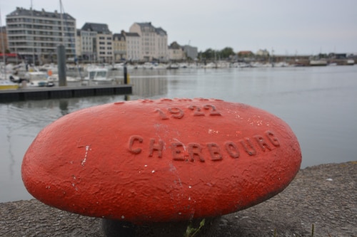
The next morning I find a big bakery – café with extra room to sit. This is also quite good, because it is a bit rainy. There is even a power outlet. So I treat myself to breakfast here and book a hotel room for the next night. According to stena-line this could be the last one in France, because the next afternoon a ferry (with bicycle!) goes to Rosslare in Ireland.
The hotel room at the Ambassadeur Hotel* is small but nice. For me it is always a strong contrast to sleep in fine white linen after nights outdoors and days in the saddle and enjoy a warm shower with aromatic soaps. There is even a storage room for bikes! So I can visit the city with fresh clothes and free of luggage. After all, it is 17 years since I was last here.
And tomorrow afternoon the Stena Horizon, the ferry to Ireland, sets sail – I will be on board!
More information about the sweet breton harbor town Roscoff
Reference to advertising links
Some links are marked with *. These are so-called affiliate links to online merchants. If you click on such a link and buy something in the store, I will receive a commission, which I can use for the design of this blog. This will not make anything more expensive for you, because the commission has already been taken into account in the pricing.
Advertising:
Picture source: Productpictures – Producer/ Vendor
